Canoeing in the Furlo Gorge
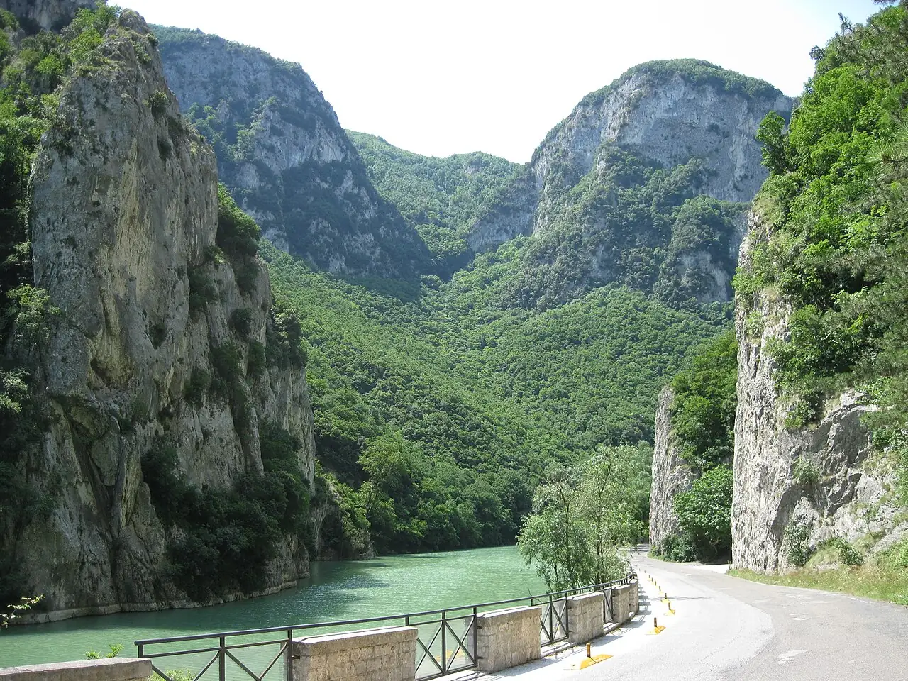
You paddle on the Candigliano between rock walls hundreds of metres high, in the gorge once crossed by the Via Flaminia, where golden eagles fly.
The story
Under Emperor Vespasian, in AD 76, the Romans cut a tunnel about 38 metres long here to carry the Via Flaminia through the gorge: you can still walk through it. Golden eagles nest on the walls of the Furlo.
Why go
Because seeing the gorge from the water, in silence, is the best way to discover the reserve.
Which wind
Good with Normal water level, windless days
Avoid with Flooding after rain
Practical information
- Activities
- Kayaking
- Level
- Beginners, with a guide
- Seabed
- Slow, deep river between limestone walls
- Best time
- May–September
- Seasons
- Summer
- Getting there
- Guided canoe trips from the village of Furlo.
Get directions ↗Marine reserve rules
Saved. You'll find everything in My trip, where you can split it into days and see it on the map.
Saved on this device: you can open it even without a connection. All your saved pages are in Offline guides.
Weather and sea forecast
The forecast for the next 7 days at this spot: sky, temperatures, rain and wind.
Forecast by Open-Meteo (CC BY 4.0), from the models of national weather services. Your browser downloads it directly from Open-Meteo, and only when you ask. In the mountains and at sea the weather changes quickly: check the official forecast as well before you set off.
Getting there
- By train. The nearest station is Pergola station, 14 km away. Alternatively: Bellisio Solfare station, 16.3 km away. From the station you need a bus, a taxi or a car.
- By air. The nearest airport is Rimini Airport (RMI), about 43 km away; with more flights, Florence Airport (FLR) is about 123 km away.
- Parking. The nearest public car park is 900 m away, free.
Stations, ports, airports and car parks from OpenStreetMap (© OpenStreetMap contributors, ODbL); distances as the crow flies. Timetables and connections change: check them before you travel.
Climate and sea month by month
The most pleasant months for weather are from April to May and from September to October, with average highs between 18 and 29 °C. From July to August it is hot: average highs exceed 30 °C. The wettest month is November (about 95 mm), the driest July.
| Month | Temperature | High / low | Rain mm |
|---|---|---|---|
| Jan | from 4 to 11 °C | 11° 4° | 62 |
| Feb | from 5 to 13 °C | 13° 5° | 72 |
| Mar | from 6 to 15 °C | 15° 6° | 69 |
| Apr | from 9 to 19 °C | 19° 9° | 57 |
| May | from 13 to 24 °C | 24° 13° | 84 |
| Jun | from 18 to 30 °C | 30° 18° | 45 |
| Jul | from 22 to 35 °C | 35° 22° | 33 |
| Aug | from 21 to 34 °C | 34° 21° | 49 |
| Sep | from 17 to 28 °C | 28° 17° | 75 |
| Oct | from 13 to 23 °C | 23° 13° | 79 |
| Nov | from 9 to 17 °C | 17° 9° | 95 |
| Dec | from 6 to 13 °C | 13° 6° | 69 |
Averages for 2015–2024, estimated for an altitude of 0 m. Air: NASA POWER (MERRA-2 reanalysis), corrected for the altitude of the place; rain: average monthly total. These are indicative values: the weather on any given day can be very different, so always check the forecast before you go.
In the guide
Other spots nearby
- Snorkelling at Portonovo and the TraveSnorkelling, SUP · 70 km
- Kayaking to the Due SorelleKayaking, SUP, Snorkelling · 74 km
- Lake FiastraSUP, Kayaking, Lake swimming · 76 km
- ★ Canyoning in the Fiastrone GorgeCanyoning · 77 km
Sea conditions can change within hours: before going in, check the marine forecast and the local harbour office (Capitaneria di porto) rules. Emergencies at sea: 1530.