Błędów Desert
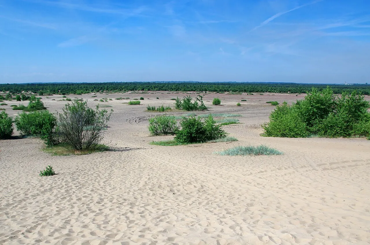
An expanse of sand covering dozens of square kilometres in the middle of the woods, known as the "Polish Sahara".
The story
The sand was deposited at the end of the ice age, but the desert is largely man-made: from the Middle Ages, clearing the forest for the local lead and silver mines left the ground bare of trees and the wind began to shift the sand, which in places is tens of metres deep. As late as the 1950s the desert covered more than thirty square kilometres; then pines and birches began to reclaim it, and today parts of it are cleared to preserve it. From two viewpoints, Czubatka and Dąbrówka, you can see the whole expanse.
Why go
A landscape you do not expect in the heart of Europe, half an hour from Katowice and Kraków.
In the itineraries
Get directions ↗OpenStreetMap ↗
Saved. You'll find everything in My trip, where you can split it into days and see it on the map.
Saved on this device: you can open it even without a connection. All your saved pages are in Offline guides.
Weather forecast
The forecast for the next 7 days at this spot: sky, temperatures, rain and wind.
Forecast by Open-Meteo (CC BY 4.0), from the models of national weather services. Your browser downloads it directly from Open-Meteo, and only when you ask. In the mountains and at sea the weather changes quickly: check the official forecast as well before you set off.
Getting there
- By train. The nearest station is Jaroszowiec Olkuski station, 7.3 km away. Alternatively: Olkusz station, 9.4 km away. From the station you need a bus, a taxi or a car.
- By air. The nearest airport is Katowice Airport (KTW), about 34 km away.
Stations, ports, airports and car parks from OpenStreetMap (© OpenStreetMap contributors, ODbL); distances as the crow flies. Timetables and connections change: check them before you travel.
Climate month by month
The most pleasant months for weather are from May to September, with average highs between 18 and 29 °C. From December to March night-time temperatures drop below freezing on average. The wettest month is July (about 87 mm), the driest March.
| Month | Temperature | High / low | Rain mm |
|---|---|---|---|
| Jan | from -5 to 1 °C | 1° -5° | 45 |
| Feb | from -3 to 4 °C | 4° -3° | 51 |
| Mar | from -1 to 8 °C | 8° -1° | 36 |
| Apr | from 3 to 13 °C | 13° 3° | 55 |
| May | from 8 to 18 °C | 18° 8° | 78 |
| Jun | from 13 to 23 °C | 23° 13° | 67 |
| Jul | from 15 to 25 °C | 25° 15° | 87 |
| Aug | from 15 to 26 °C | 26° 15° | 82 |
| Sep | from 10 to 21 °C | 21° 10° | 81 |
| Oct | from 5 to 14 °C | 14° 5° | 60 |
| Nov | from 1 to 7 °C | 7° 1° | 44 |
| Dec | from -3 to 2 °C | 2° -3° | 46 |
Averages for 2015–2024, estimated for an altitude of 315 m. Air: NASA POWER (MERRA-2 reanalysis), corrected for the altitude of the place; rain: average monthly total. These are indicative values: the weather on any given day can be very different, so always check the forecast before you go.
Nearby
- Ogrodzieniec CastleHistory and art · 11 km as the crow flies
- Mirów and Bobolice castlesHistory and art · 29 km as the crow flies
- ★ NikiszowiecTown · 33 km as the crow flies
- Katowice, the Culture ZoneHistory and art · 36 km as the crow flies
- Tarnowskie Góry silver mineHistory and art · 48 km as the crow flies
- Guido MineHistory and art · 53 km as the crow flies