The stone fields of the Holy Cross Mountains
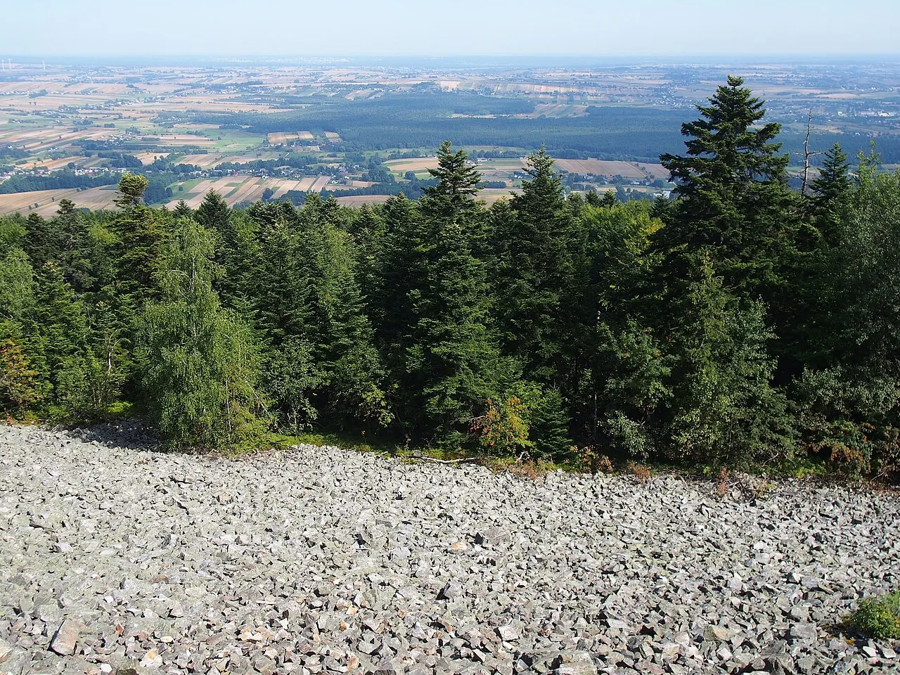
Great treeless slopes of frost-shattered quartzite in the middle of the fir forest: they look like rivers of stone.
The story
The Holy Cross Mountains are among the oldest in Europe: their rocks formed more than four hundred million years ago, and the mountains have been worn down to barely six hundred metres. During the last Ice Age, frost shattered the summits and the blocks slid down the slopes, forming the “gołoborza”, stone fields where nothing grows even today. The national park protects them: on Łysica and Łysa Góra you can see them from boardwalks and viewing terraces.
Why go
A rare landscape, easy to reach on foot from the monastery.
In the itineraries
Get directions ↗OpenStreetMap ↗
Saved. You'll find everything in My trip, where you can split it into days and see it on the map.
Saved on this device: you can open it even without a connection. All your saved pages are in Offline guides.
Weather forecast
The forecast for the next 7 days at this spot: sky, temperatures, rain and wind.
Forecast by Open-Meteo (CC BY 4.0), from the models of national weather services. Your browser downloads it directly from Open-Meteo, and only when you ask. In the mountains and at sea the weather changes quickly: check the official forecast as well before you set off.
Getting there
- By train. The nearest station is Starachowice Michałów station, 17.5 km away. Alternatively: Styków Iłżecki station, 17.9 km away. From the station you need a bus, a taxi or a car.
- By air. The nearest airport is Warsaw-Radom Airport (RDO), about 60 km away; with more flights, Kraków Airport (KRK) is about 125 km away.
- Parking. The nearest public car park is 600 m away.
Stations, ports, airports and car parks from OpenStreetMap (© OpenStreetMap contributors, ODbL); distances as the crow flies. Timetables and connections change: check them before you travel.
Climate month by month
The most pleasant months for weather are from June to September, with average highs between 18 and 29 °C. From November to March night-time temperatures drop below freezing on average. The wettest month is July (about 80 mm), the driest March.
| Month | Temperature | High / low | Rain mm |
|---|---|---|---|
| Jan | from -7 to -1 °C | -1° -7° | 44 |
| Feb | from -5 to 2 °C | 2° -5° | 40 |
| Mar | from -3 to 6 °C | 6° -3° | 37 |
| Apr | from 1 to 12 °C | 12° 1° | 51 |
| May | from 6 to 17 °C | 17° 6° | 70 |
| Jun | from 12 to 22 °C | 22° 12° | 59 |
| Jul | from 13 to 24 °C | 24° 13° | 80 |
| Aug | from 13 to 25 °C | 25° 13° | 69 |
| Sep | from 9 to 19 °C | 19° 9° | 69 |
| Oct | from 3 to 13 °C | 13° 3° | 54 |
| Nov | from -1 to 5 °C | 5° -1° | 40 |
| Dec | from -4 to 0 °C | 0° -4° | 44 |
Averages for 2015–2024, estimated for an altitude of 510 m. Air: NASA POWER (MERRA-2 reanalysis), corrected for the altitude of the place; rain: average monthly total. These are indicative values: the weather on any given day can be very different, so always check the forecast before you go.
Nearby
- Holy Cross MonasteryHistory and art · less than 1 km as the crow flies
- Nowa Słupia and the ancient smithsHistory and art · 2 km as the crow flies
- ŁysicaNature · 12 km as the crow flies
- Krzyżtopór CastleHistory and art · 24 km as the crow flies
- Opatów and its cellarsTown · 27 km as the crow flies
- Kielce and the Bishops' PalaceTown · 30 km as the crow flies
← See it on the map with all 16 placesGuide to Świętokrzyskie