Duino and the Rilke Trail
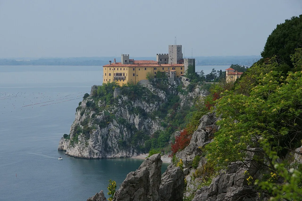
A castle on a white cliff dropping sheer to the sea, linked to Sistiana by a scenic path through holm oaks and karst rock.
The story
In the winter of 1911–1912 the poet Rainer Maria Rilke was the guest of Princess Marie von Thurn und Taxis at the castle. Walking on the cliff on a day of bora, by his own account, he heard a voice dictating the first line of what became the «Duino Elegies», among the most important works of 20th-century poetry. The path that bears his name follows the coast for about two kilometres.
Why go
An easy, spectacular walk above the Gulf of Trieste, with a visit to the castle.
In the itineraries
Get directions ↗OpenStreetMap ↗
Saved. You'll find everything in My trip, where you can split it into days and see it on the map.
Saved on this device: you can open it even without a connection. All your saved pages are in Offline guides.
Weather forecast
The forecast for the next 7 days at this spot: sky, temperatures, rain and wind.
Forecast by Open-Meteo (CC BY 4.0), from the models of national weather services. Your browser downloads it directly from Open-Meteo, and only when you ask. In the mountains and at sea the weather changes quickly: check the official forecast as well before you set off.
Getting there
- By train. The nearest station is Sistiana-Visogliano station, 3.2 km away. Alternatively: Bivio d'Aurisina / Nabrežina bivio station, 4.6 km away. From the station you need a bus, a taxi or a car.
- By sea. The nearest ferry terminal is Sistiana / Sesljan, 2.1 km away.
- By air. The nearest airport is Trieste Airport (TRS), about 11 km away; with more flights, Venice Airport (VCE) is about 103 km away.
- Parking. There are 9 signposted car parks within a kilometre; the nearest is 50 m away.
Stations, ports, airports and car parks from OpenStreetMap (© OpenStreetMap contributors, ODbL); distances as the crow flies. Timetables and connections change: check them before you travel.
Climate month by month
The most pleasant months for weather are from May to August, with average highs between 18 and 29 °C. The wettest month is September (about 153 mm), the driest March.
| Month | Temperature | High / low | Rain mm |
|---|---|---|---|
| Jan | from 1 to 9 °C | 9° 1° | 84 |
| Feb | from 3 to 10 °C | 10° 3° | 90 |
| Mar | from 5 to 12 °C | 12° 5° | 82 |
| Apr | from 8 to 16 °C | 16° 8° | 88 |
| May | from 13 to 20 °C | 20° 13° | 139 |
| Jun | from 18 to 26 °C | 26° 18° | 101 |
| Jul | from 20 to 29 °C | 29° 20° | 103 |
| Aug | from 20 to 29 °C | 29° 20° | 113 |
| Sep | from 15 to 24 °C | 24° 15° | 153 |
| Oct | from 11 to 19 °C | 19° 11° | 147 |
| Nov | from 6 to 14 °C | 14° 6° | 138 |
| Dec | from 3 to 10 °C | 10° 3° | 114 |
Averages for 2015–2024, estimated for an altitude of 42 m. Air: NASA POWER (MERRA-2 reanalysis), corrected for the altitude of the place; rain: average monthly total. These are indicative values: the weather on any given day can be very different, so always check the forecast before you go.
On foot and on the water, nearby
- Rilke Trail, from Duino to SistianaTrail · T · 1.9 km · +60 m · 45 minutes–1 hour · less than 1 km
- ★ Kayaking beneath the Duino cliffsWater sports · Kayaking, SUP, Snorkelling · Beginner to intermediate · less than 1 km
- Snorkelling in the Miramare reserveWater sports · Snorkelling · Beginners, with a guide · 12 km
Nearby
- ★ Karst osmizeTown · 11 km as the crow flies
- Miramare CastleHistory and art · 11 km as the crow flies
- Redipuglia War MemorialHistory and art · 12 km as the crow flies
- Grotta GiganteNature · 14 km as the crow flies
- AquileiaHistory and art · 18 km as the crow flies
- ★ Gorizia and the TransalpinaTown · 19 km as the crow flies
← See it on the map with all 25 placesGuide to Friuli Venezia Giulia