Garden of Ninfa
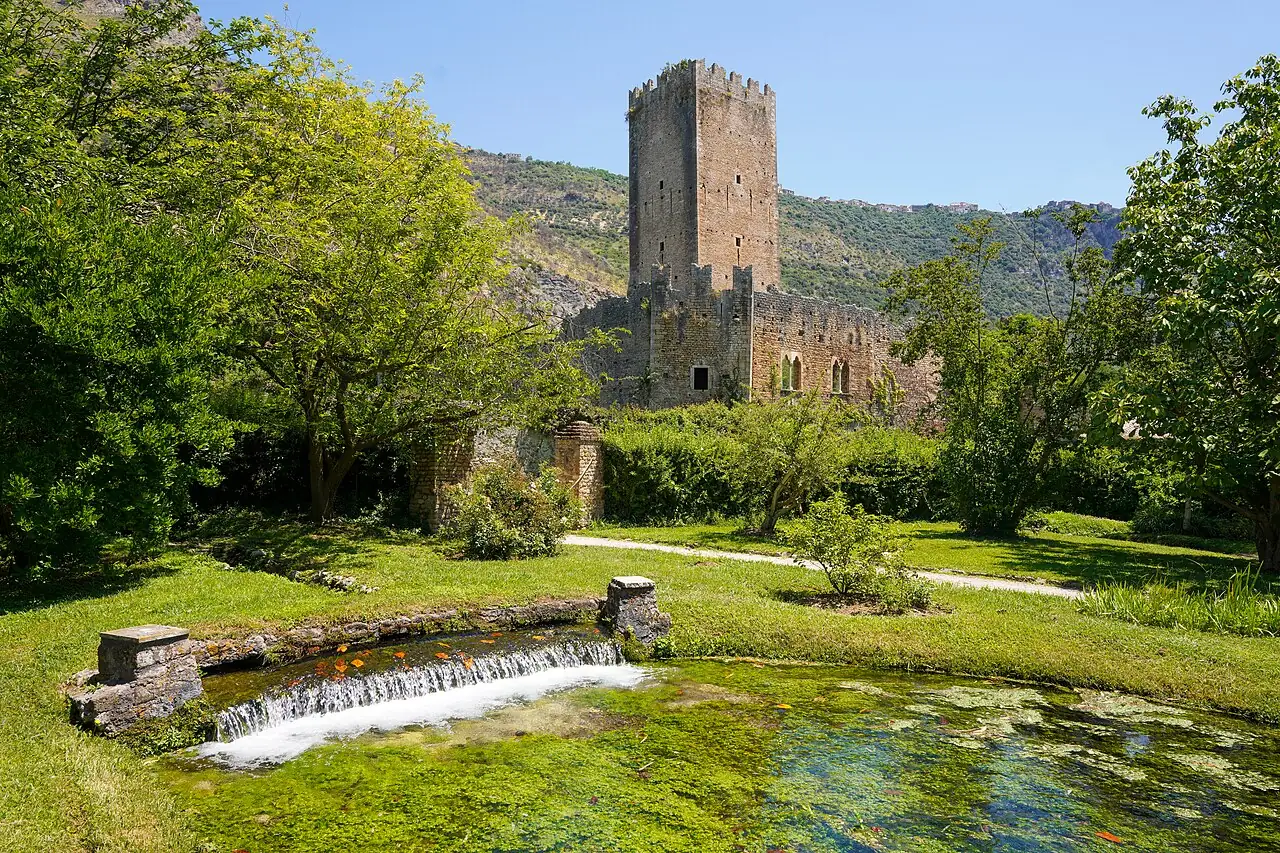
A romantic garden among the ruins of a medieval town, crossed by a crystal-clear river, with climbing roses on the walls and plants from all over the world.
The story
Ninfa was a prosperous little town until, at the end of the 14th century, it was sacked and then abandoned because of the malaria rising from the marshes. From 1921 the Caetani family began turning the ruins into a garden, and generations of the family's women enriched it. Today it is a protected natural monument and is often listed among the most beautiful gardens in the world.
Why go
An enchanted, timeless place that can only be visited on certain days of the year.
In the itineraries
Get directions ↗OpenStreetMap ↗
Saved. You'll find everything in My trip, where you can split it into days and see it on the map.
Saved on this device: you can open it even without a connection. All your saved pages are in Offline guides.
Weather forecast
The forecast for the next 7 days at this spot: sky, temperatures, rain and wind.
Forecast by Open-Meteo (CC BY 4.0), from the models of national weather services. Your browser downloads it directly from Open-Meteo, and only when you ask. In the mountains and at sea the weather changes quickly: check the official forecast as well before you set off.
Getting there
- By train. The nearest station is Latina station, 5.2 km away. Alternatively: Cisterna di Latina station, 10.4 km away. From the station you need a bus, a taxi or a car.
- By air. The nearest airport is Rome-Ciampino Airport (CIA), about 38 km away.
- Parking. The nearest public car park (Parcheggio Giardini di Ninfa) is 250 m away, free.
Stations, ports, airports and car parks from OpenStreetMap (© OpenStreetMap contributors, ODbL); distances as the crow flies. Timetables and connections change: check them before you travel.
Climate month by month
The most pleasant months for weather are from April to June and from September to November, with average highs between 18 and 29 °C. From July to August it is hot: average highs exceed 30 °C. The wettest month is November (about 136 mm), the driest July.
| Month | Temperature | High / low | Rain mm |
|---|---|---|---|
| Jan | from 5 to 14 °C | 14° 5° | 69 |
| Feb | from 6 to 14 °C | 14° 6° | 63 |
| Mar | from 7 to 15 °C | 15° 7° | 62 |
| Apr | from 10 to 18 °C | 18° 10° | 41 |
| May | from 14 to 22 °C | 22° 14° | 47 |
| Jun | from 19 to 27 °C | 27° 19° | 48 |
| Jul | from 23 to 31 °C | 31° 23° | 18 |
| Aug | from 23 to 31 °C | 31° 23° | 29 |
| Sep | from 19 to 28 °C | 28° 19° | 69 |
| Oct | from 15 to 23 °C | 23° 15° | 88 |
| Nov | from 11 to 19 °C | 19° 11° | 136 |
| Dec | from 7 to 16 °C | 16° 7° | 77 |
Averages for 2015–2024, estimated for an altitude of 62 m. Air: NASA POWER (MERRA-2 reanalysis), corrected for the altitude of the place; rain: average monthly total. These are indicative values: the weather on any given day can be very different, so always check the forecast before you go.