The Barolo Crus Trail
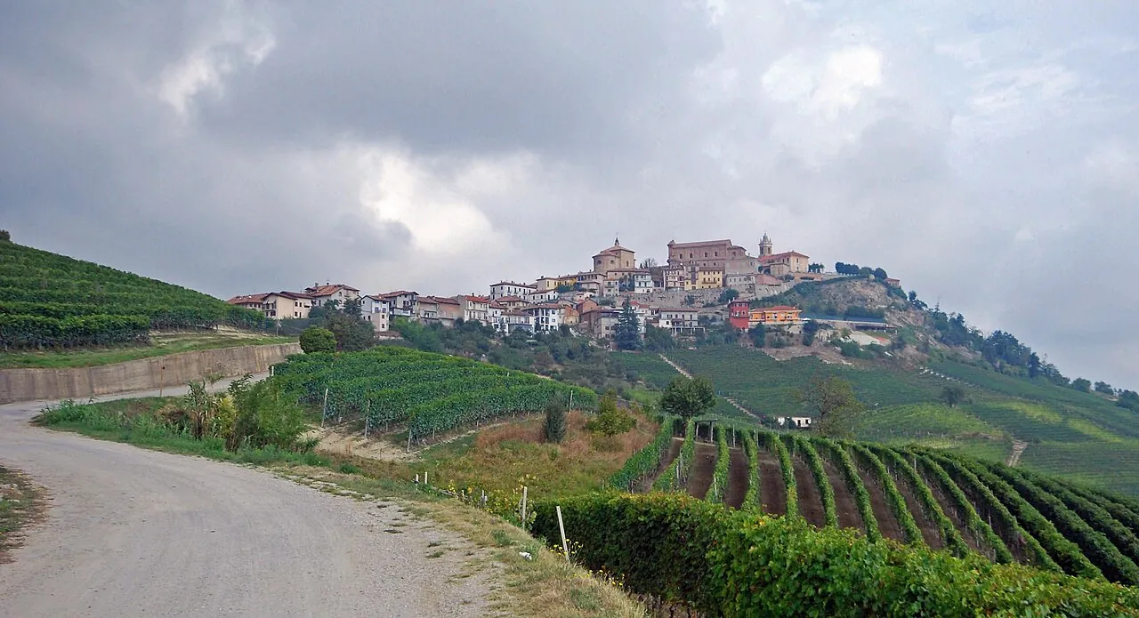
A loop through the most famous Barolo vineyards, below the La Morra viewpoint: you walk the growers' roads from one cru to the next, with the Langhe hills all around.
- Difficulty
- T Tourist
- Length
- 11.7 km
- Elevation gain
- +330 m / −370 m
- Time
- 3.5–4 hours
- Route
- Loop
- Altitude
- 220–505 m
- Season
- Spring Autumn
Download the GPXDirections to the start ↗
Saved. You'll find everything in My trip, where you can split it into days and see it on the map.
Saved on this device: you can open it even without a connection. All your saved pages are in Offline guides.
The topographic map loads OpenTopoMap tiles (an external server) only when you open it.
The story
In the Langhe every hill has a name, and vineyard names, the 'additional geographical mentions', appear on the label as in Burgundy. This landscape of vineyards, wineries and castles has been a UNESCO World Heritage Site since 2014 (Langhe-Roero and Monferrato).
Why go
Because you only really understand Barolo by walking among its vines, and because the route passes close to the Barolo Chapel painted by Sol LeWitt and David Tremlett.
Practical information
- Start
- La Morra
- Finish
- Loop
- Best time
- April–June and September–November
- Parking
- Car parks in the village of La Morra.
- By public transport
- Bus from Alba to La Morra, with few runs.
- Water
- Fountains and cafés in the village; nothing among the vineyards.
- Shade
- Very little: vineyards as far as the eye can see.
- Huts and refreshments
- Wineries and osterie along the route (check opening times and book).
- With children
- Yes, but it gets very hot in summer.
Weather at the start
The forecast for the next 7 days at this spot: sky, temperatures, rain and wind.
Forecast by Open-Meteo (CC BY 4.0), from the models of national weather services. Your browser downloads it directly from Open-Meteo, and only when you ask. In the mountains and at sea the weather changes quickly: check the official forecast as well before you set off.
What to see on the route and nearby
- BaroloOn the route
- ★ Barolo ChapelOn the route
- Pollenzo and Bra6 km from the start
- Alba11 km from the start
More hikes in Piedmont
- 1Sacra di San Michele from Sant'AmbrogioE 5.7 km · +500 m · 3 hours · out and back
- 2★ Buco di Viso from Pian del ReE 9.1 km · +960 m · 5–6 hours · out and back
- 3★ Pian del Valasco from Terme di ValdieriE 8.6 km · +440 m · 3–3.5 hours · out and back
- 5★ Bessa Reserve, the Romans' gold minesE 4.5 km · +60 m · 1.5–2 hours · out and back
- 6★ Cicogna–Pogallo, in the heart of the Val GrandeE 7.8 km · +340 m · 3–3.5 hours · out and back
- 7On foot to the Sacred Mountain of VaralloT 2.4 km · +130 m · 1 hour round trip, plus the visit · out and back
- 8Lago del Mucrone from OropaE 10.3 km · +720 m · 4–4.5 hours round trip · out and back
- 9★ Alpe Otro, the Walser villages above AlagnaE 6.8 km · +420 m · 3 hours round trip · out and back
- 10Alpe Devero and Crampiolo, snowshoes tooT 6.1 km · +170 m · 1.5–2 hours round trip · out and back
Routes © OpenStreetMap contributors (ODbL), via Waymarked Trails and BRouter; elevations from a digital terrain model. Times and elevation gains are indicative: waymarks on the ground and closure orders always take precedence.