Lake Mergozzo
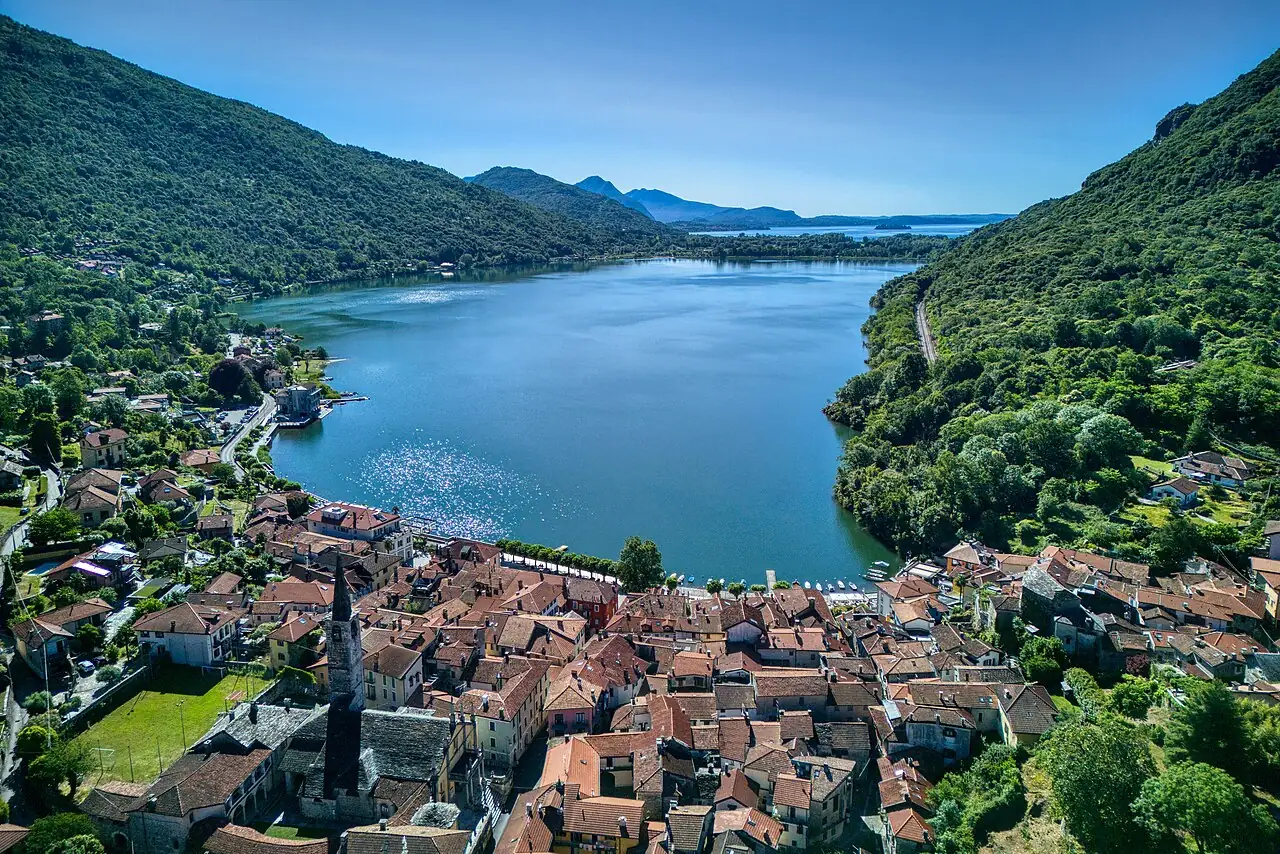
A small lake next to Lake Maggiore, separated by a thin strip of land: motorboats are not allowed, and the water is among the cleanest in northern Italy.
The story
It was originally an inlet of Lake Maggiore: sediment carried by the river Toce cut it off in the Middle Ages. The village of Mergozzo, with its stone houses, has kept the life of a village of fishermen and quarrymen.
Why go
Because it is the ideal place for your first time on a SUP or in a kayak, on a silent lake with no motorboat wash.
Which wind
Good with Morning, with a calm lake
Avoid with Windy afternoons
Practical information
- Activities
- SUP, Kayaking, Lake swimming
- Level
- Beginners
- Seabed
- Clear water, rocky shores and small beaches
- Best time
- June–September
- Seasons
- Summer
- Getting there
- Public beaches and rentals in Mergozzo.
Get directions ↗Marine reserve rules
Saved. You'll find everything in My trip, where you can split it into days and see it on the map.
Saved on this device: you can open it even without a connection. All your saved pages are in Offline guides.
Weather and sea forecast
The forecast for the next 7 days at this spot: sky, temperatures, rain and wind.
Forecast by Open-Meteo (CC BY 4.0), from the models of national weather services. Your browser downloads it directly from Open-Meteo, and only when you ask. In the mountains and at sea the weather changes quickly: check the official forecast as well before you set off.
Getting there
- By train. The nearest station is Verbania-Pallanza station, 1.2 km away (about 20 minutes on foot). Alternatively: Mergozzo station, 2.2 km away.
- By air. The nearest airport is Milan-Malpensa Airport (MXP), about 41 km away.
- Parking. There are 2 signposted car parks within a kilometre; the nearest is 900 m away.
Stations, ports, airports and car parks from OpenStreetMap (© OpenStreetMap contributors, ODbL); distances as the crow flies. Timetables and connections change: check them before you travel.
Climate and sea month by month
The most pleasant months for weather are April and from June to September, with average highs between 18 and 29 °C. The wettest month is May (about 155 mm), the driest January.
| Month | Temperature | High / low | Rain mm |
|---|---|---|---|
| Jan | from 1 to 8 °C | 8° 1° | 48 |
| Feb | from 3 to 10 °C | 10° 3° | 66 |
| Mar | from 6 to 14 °C | 14° 6° | 80 |
| Apr | from 9 to 18 °C | 18° 9° | 95 |
| May | from 13 to 21 °C | 21° 13° | 155 |
| Jun | from 19 to 26 °C | 26° 19° | 134 |
| Jul | from 21 to 29 °C | 29° 21° | 109 |
| Aug | from 20 to 28 °C | 28° 20° | 127 |
| Sep | from 16 to 24 °C | 24° 16° | 116 |
| Oct | from 12 to 20 °C | 20° 12° | 153 |
| Nov | from 7 to 13 °C | 13° 7° | 100 |
| Dec | from 3 to 9 °C | 9° 3° | 62 |
Averages for 2015–2024, estimated for an altitude of 193 m. Air: NASA POWER (MERRA-2 reanalysis), corrected for the altitude of the place; rain: average monthly total. These are indicative values: the weather on any given day can be very different, so always check the forecast before you go.
In the guide
Nearby hikes
Other spots nearby
- By kayak to the Island of San GiulioKayaking, SUP · 18 km
- ★ The Castles of Cannero by kayakKayaking, SUP · 20 km
- Rafting on the SesiaRafting and canoeing, Kayaking · 30 km
- ★ Ivrea canoe stadiumKayaking, Rafting and canoeing · 71 km
River levels and lake winds change within hours: before going in the water, check the forecast and the local rules. Emergencies: 112.