Val di Fassa and the Marmolada
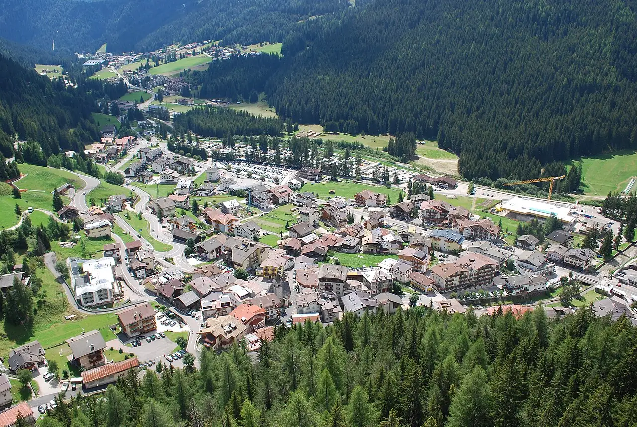
Trentino's Ladin valley, with Canazei, the Sella and the Marmolada, the 'queen of the Dolomites', 3,343 metres high. In summer you hike to the mountain huts; in winter you ski the Sellaronda circuit.
In the itineraries
Get directions ↗OpenStreetMap ↗
Saved. You'll find everything in My trip, where you can split it into days and see it on the map.
Saved on this device: you can open it even without a connection. All your saved pages are in Offline guides.
Weather forecast
The forecast for the next 7 days at this spot: sky, temperatures, rain and wind.
Forecast by Open-Meteo (CC BY 4.0), from the models of national weather services. Your browser downloads it directly from Open-Meteo, and only when you ask. In the mountains and at sea the weather changes quickly: check the official forecast as well before you set off.
Getting there
- By train. The nearest station is Ponte Gardena-Laion station, 22.9 km away. Alternatively: Chiusa station, 23.9 km away. From the station you need a bus, a taxi or a car.
- By air. The nearest airport is Bolzano-Dolomiti Airport (BZO), about 34 km away; with more flights, Venice Airport (VCE) is about 118 km away.
- Parking. There are many signposted car parks within a kilometre; the nearest is 100 m away, paid.
Stations, ports, airports and car parks from OpenStreetMap (© OpenStreetMap contributors, ODbL); distances as the crow flies. Timetables and connections change: check them before you travel.
Climate month by month
The most pleasant months for weather are from June to August, with average highs between 18 and 29 °C. From November to March night-time temperatures drop below freezing on average. The wettest month is August (about 137 mm), the driest January.
| Month | Temperature | High / low | Rain mm |
|---|---|---|---|
| Jan | from -9 to 0 °C | 0° -9° | 36 |
| Feb | from -7 to 2 °C | 2° -7° | 40 |
| Mar | from -4 to 6 °C | 6° -4° | 46 |
| Apr | from 0 to 10 °C | 10° 0° | 70 |
| May | from 4 to 14 °C | 14° 4° | 126 |
| Jun | from 9 to 20 °C | 20° 9° | 114 |
| Jul | from 11 to 21 °C | 21° 11° | 122 |
| Aug | from 11 to 21 °C | 21° 11° | 137 |
| Sep | from 7 to 17 °C | 17° 7° | 105 |
| Oct | from 3 to 12 °C | 12° 3° | 109 |
| Nov | from -2 to 6 °C | 6° -2° | 71 |
| Dec | from -6 to 1 °C | 1° -6° | 49 |
Averages for 2015–2024, estimated for an altitude of 1462 m. Air: NASA POWER (MERRA-2 reanalysis), corrected for the altitude of the place; rain: average monthly total. These are indicative values: the weather on any given day can be very different, so always check the forecast before you go.
On foot and on the water, nearby
- Viel dal Pan, the bread pathTrail · E · 6.8 km · +220 m · 2.5–3 hours · 3 km
- Around the Sassolungo and SassopiattoTrail · EE · 17.3 km · +900 m · 6–7 hours · 3 km
- The Vallunga from SelvaTrail · T · 11.7 km · +260 m · 3–3.5 hours round trip · 9 km
- Alpe di Siusi: from Compaccio to SaltriaTrail · T · 5.8 km · +40 m · 1.5–2 hours · 14 km
Nearby
- Alpe di SiusiNature · 14 km as the crow flies
- Val Gardena and SecedaNature · 14 km as the crow flies
- Val BadiaNature · 16 km as the crow flies
- Lago di CarezzaNature · 17 km as the crow flies
- ★ Paneveggio ForestNature · 19 km as the crow flies
- Val di FunesNature · 19 km as the crow flies
← See it on the map with all 27 placesGuide to Trentino-South Tyrol