Larderello and the Devil's Valley
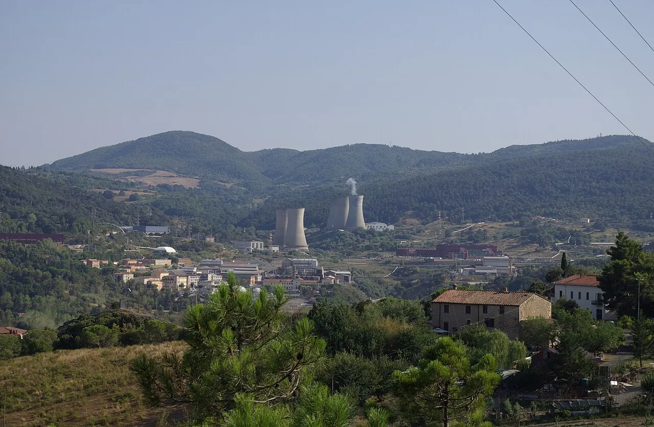
A valley in the Metalliferous Hills where steam vents burst from the ground, pools bubble and big silver pipes snake through the woods.
The story
In the 19th century the French entrepreneur François de Larderel, after whom the village is named, began extracting boric acid from the steaming pools. On 4 July 1904 Prince Piero Ginori Conti lit a few light bulbs here using steam power: it was the first time in the world that the Earth's heat produced electricity. A few years later the first geothermal power station was built, and the area still produces much of Italy's geothermal energy. Tradition has it that the smoking landscape inspired Dante's Inferno.
Why go
The geothermal museum and the trails among the fumaroles (at Sasso Pisano and Monterotondo Marittimo) show a side of Tuscany almost nobody knows.
In the itineraries
Get directions ↗OpenStreetMap ↗
Saved. You'll find everything in My trip, where you can split it into days and see it on the map.
Saved on this device: you can open it even without a connection. All your saved pages are in Offline guides.
Weather forecast
The forecast for the next 7 days at this spot: sky, temperatures, rain and wind.
Forecast by Open-Meteo (CC BY 4.0), from the models of national weather services. Your browser downloads it directly from Open-Meteo, and only when you ask. In the mountains and at sea the weather changes quickly: check the official forecast as well before you set off.
Getting there
- By train. The nearest station is Volterra-Saline-Pomarance station, 14.7 km away. Alternatively: Ponteginori station, 15.5 km away. From the station you need a bus, a taxi or a car.
- By air. The nearest airport is Pisa Airport (PSA), about 63 km away.
- Parking. There are 2 signposted car parks within a kilometre; the nearest (Museo Geothermica) is 350 m away.
Stations, ports, airports and car parks from OpenStreetMap (© OpenStreetMap contributors, ODbL); distances as the crow flies. Timetables and connections change: check them before you travel.
Climate month by month
The most pleasant months for weather are from May to October, with average highs between 18 and 29 °C. The wettest month is November (about 76 mm), the driest July.
| Month | Temperature | High / low | Rain mm |
|---|---|---|---|
| Jan | from 5 to 10 °C | 10° 5° | 40 |
| Feb | from 6 to 11 °C | 11° 6° | 52 |
| Mar | from 6 to 13 °C | 13° 6° | 45 |
| Apr | from 9 to 16 °C | 16° 9° | 34 |
| May | from 13 to 20 °C | 20° 13° | 43 |
| Jun | from 17 to 25 °C | 25° 17° | 23 |
| Jul | from 20 to 28 °C | 28° 20° | 15 |
| Aug | from 21 to 29 °C | 29° 21° | 28 |
| Sep | from 17 to 24 °C | 24° 17° | 46 |
| Oct | from 14 to 20 °C | 20° 14° | 67 |
| Nov | from 10 to 15 °C | 15° 10° | 76 |
| Dec | from 7 to 12 °C | 12° 7° | 52 |
Averages for 2015–2024, estimated for an altitude of 384 m. Air: NASA POWER (MERRA-2 reanalysis), corrected for the altitude of the place; rain: average monthly total. These are indicative values: the weather on any given day can be very different, so always check the forecast before you go.