Chamois
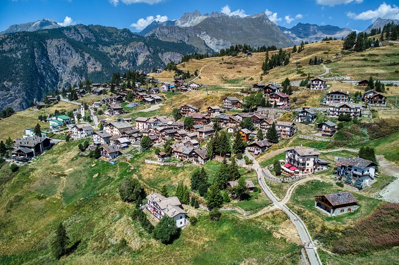
A village of chalets and meadows at 1,800 metres above the Valtournenche, with a small lake and a view of the Matterhorn, where no cars are allowed.
The story
Chamois is the only municipality in Italy that cannot be reached by road. Until 1955 the only way up was on foot or by mule; then a cable car was built from Buisson, and the villagers chose not to have a road. Today you ride up the cable car in a few minutes, or walk the old mule track.
Why go
A car-free, quiet village, with easy paths and peaceful ski runs.
In the itineraries
Get directions ↗OpenStreetMap ↗
Saved. You'll find everything in My trip, where you can split it into days and see it on the map.
Saved on this device: you can open it even without a connection. All your saved pages are in Offline guides.
Weather forecast
The forecast for the next 7 days at this spot: sky, temperatures, rain and wind.
Forecast by Open-Meteo (CC BY 4.0), from the models of national weather services. Your browser downloads it directly from Open-Meteo, and only when you ask. In the mountains and at sea the weather changes quickly: check the official forecast as well before you set off.
Getting there
- By train. The nearest station is Châtillon-Saint-Vincent station, 10.5 km away. Alternatively: Nus station, 16 km away. From the station you need a bus, a taxi or a car.
- By air. The nearest airport is Turin Airport (TRN), about 71 km away.
- Parking. The nearest public car park is 800 m away.
- ZTL. Many Italian historic centres are limited traffic zones (ZTL) monitored by cameras: if you arrive by car, leave it outside the centre and check opening times and permits on the town council's website (your hotel may be able to register your plate).
Stations, ports, airports and car parks from OpenStreetMap (© OpenStreetMap contributors, ODbL); distances as the crow flies. Timetables and connections change: check them before you travel.
Climate month by month
The most pleasant months for weather are from July to August, with average highs between 18 and 29 °C. From November to April night-time temperatures drop below freezing on average. The wettest month is May (about 117 mm), the driest February.
| Month | Temperature | High / low | Rain mm |
|---|---|---|---|
| Jan | from -11 to -2 °C | -2° -11° | 80 |
| Feb | from -9 to 0 °C | 0° -9° | 55 |
| Mar | from -7 to 1 °C | 1° -7° | 76 |
| Apr | from -2 to 6 °C | 6° -2° | 65 |
| May | from 2 to 11 °C | 11° 2° | 117 |
| Jun | from 7 to 16 °C | 16° 7° | 109 |
| Jul | from 9 to 19 °C | 19° 9° | 84 |
| Aug | from 9 to 18 °C | 18° 9° | 94 |
| Sep | from 5 to 14 °C | 14° 5° | 79 |
| Oct | from 2 to 10 °C | 10° 2° | 96 |
| Nov | from -4 to 3 °C | 3° -4° | 81 |
| Dec | from -8 to 0 °C | 0° -8° | 87 |
Averages for 2015–2024, estimated for an altitude of 1812 m. Air: NASA POWER (MERRA-2 reanalysis), corrected for the altitude of the place; rain: average monthly total. These are indicative values: the weather on any given day can be very different, so always check the forecast before you go.
On foot and on the water, nearby
- ★ On foot to Chamois, the car-free villageTrail · E · 4.9 km · +460 m · 2.5 hours · 4 km
- Lago Blu, the Matterhorn's mirrorTrail · T · 3.3 km · +20 m · 1 hour round trip · 11 km
- ★ Rifugio Oriondé and Croce CarrelTrail · EE · 9.5 km · +880 m · 5 hours · 11 km
- ★ Ru MarseillerTrail · T · 11.5 km · +510 m · 3–3.5 hours · 11 km
Nearby
- Breuil-Cervinia and the MatterhornNature · 11 km as the crow flies
- Fénis CastleHistory and art · 15 km as the crow flies
- Gressoney and Castel SavoiaTown · 17 km as the crow flies
- ★ Issogne CastleHistory and art · 21 km as the crow flies
- AostaHistory and art · 26 km as the crow flies
- Fort BardHistory and art · 27 km as the crow flies