Pietra di Bismantova
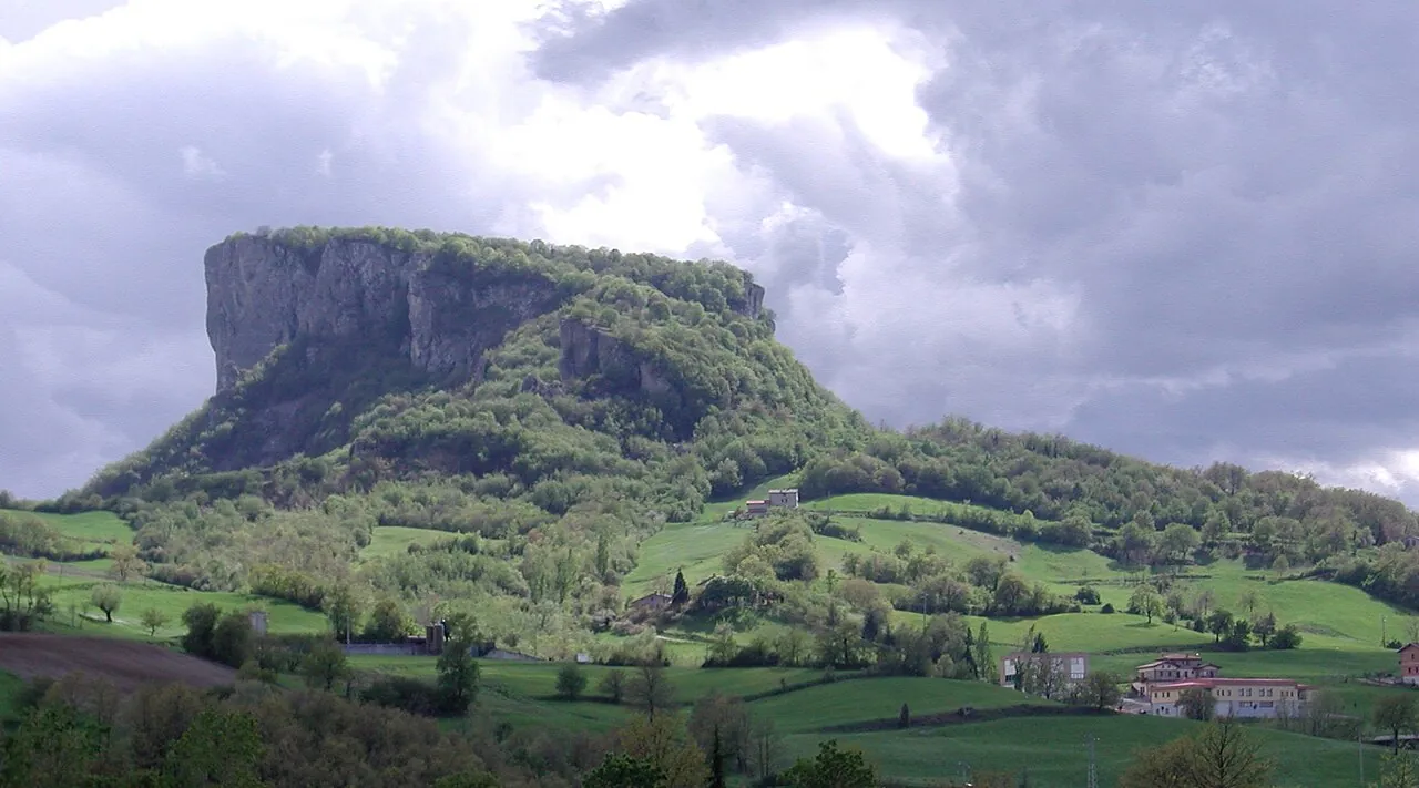
A huge ship-shaped sandstone outcrop rising alone in the Reggio Apennines, with sheer walls and a plateau on top.
The story
Dante mentions it in the fourth canto of Purgatorio, comparing the effort of the climb to that of reaching the top of Bismantova; in the same tercet he names San Leo and Noli. Below the wall there is a hermitage, and climbers have been scaling the rock for decades.
Why go
A half-hour path takes you to the top, with a view that ranges from the Apennine ridge to the Alps on clear days.
In the itineraries
Get directions ↗OpenStreetMap ↗
Saved. You'll find everything in My trip, where you can split it into days and see it on the map.
Saved on this device: you can open it even without a connection. All your saved pages are in Offline guides.
Weather forecast
The forecast for the next 7 days at this spot: sky, temperatures, rain and wind.
Forecast by Open-Meteo (CC BY 4.0), from the models of national weather services. Your browser downloads it directly from Open-Meteo, and only when you ask. In the mountains and at sea the weather changes quickly: check the official forecast as well before you set off.
Getting there
- By train. The nearest station is Ciano d’Enza station, 19.3 km away. Alternatively: Ciano Via Tedaldo da Canossa station, 20.3 km away. From the station you need a bus, a taxi or a car.
- By air. The nearest airport is Parma Airport (PMF), about 45 km away; with more flights, Bologna Airport (BLQ) is about 71 km away.
- Parking. There are 3 signposted car parks within a kilometre; the nearest (Piazzale Dante) is 550 m away.
Stations, ports, airports and car parks from OpenStreetMap (© OpenStreetMap contributors, ODbL); distances as the crow flies. Timetables and connections change: check them before you travel.
Climate month by month
The most pleasant months for weather are from May to September, with average highs between 18 and 29 °C. From December to March night-time temperatures drop below freezing on average. The wettest month is May (about 82 mm), the driest July.
| Month | Temperature | High / low | Rain mm |
|---|---|---|---|
| Jan | from -4 to 4 °C | 4° -4° | 39 |
| Feb | from -2 to 6 °C | 6° -2° | 58 |
| Mar | from -1 to 9 °C | 9° -1° | 43 |
| Apr | from 2 to 14 °C | 14° 2° | 42 |
| May | from 7 to 18 °C | 18° 7° | 82 |
| Jun | from 12 to 24 °C | 24° 12° | 50 |
| Jul | from 15 to 29 °C | 29° 15° | 30 |
| Aug | from 15 to 28 °C | 28° 15° | 40 |
| Sep | from 10 to 22 °C | 22° 10° | 54 |
| Oct | from 6 to 16 °C | 16° 6° | 76 |
| Nov | from 1 to 9 °C | 9° 1° | 77 |
| Dec | from -2 to 5 °C | 5° -2° | 50 |
Averages for 2015–2024, estimated for an altitude of 1015 m. Air: NASA POWER (MERRA-2 reanalysis), corrected for the altitude of the place; rain: average monthly total. These are indicative values: the weather on any given day can be very different, so always check the forecast before you go.
On foot and on the water, nearby
- Pietra di Bismantova loopTrail · E · 3.6 km · +290 m · 2–2.5 hours · less than 1 km
- Monte Ventasso from Lago CalamoneTrail · E · 4.9 km · +380 m · 3 hours round trip · 12 km
Nearby
- ★ Canossa CastleHistory and art · 18 km as the crow flies
- Torrechiara CastleHistory and art · 28 km as the crow flies
- ★ Salse di NiranoNature · 34 km as the crow flies
- Maranello and the Enzo Ferrari MuseumHistory and art · 37 km as the crow flies
- ParmaTown · 43 km as the crow flies
- ModenaTown · 48 km as the crow flies
← See it on the map with all 27 placesGuide to Emilia-Romagna