Monte Ventasso from Lago Calamone
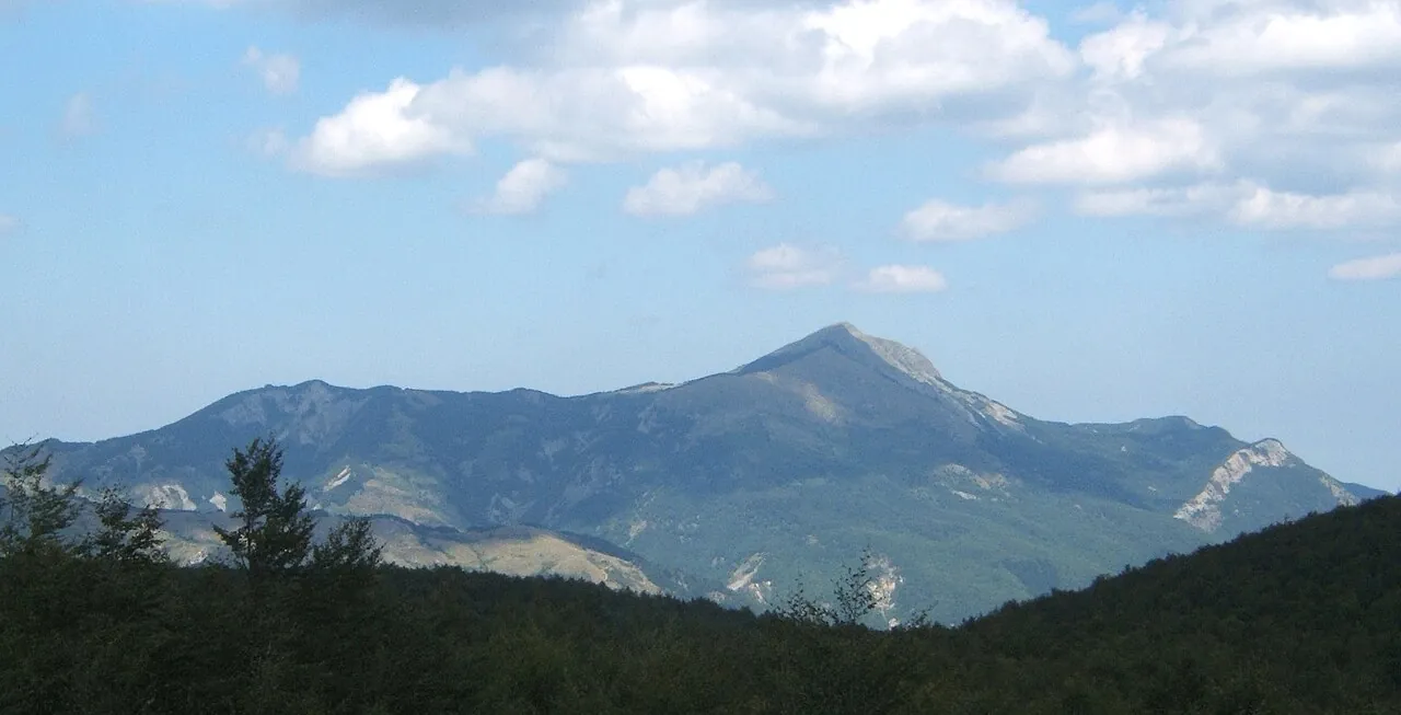
From the glacial Lago Calamone you climb through the beech forest to the top of the Ventasso, a solitary mountain in the Tuscan-Emilian Apennine National Park, with the little church of Santa Maria Maddalena on the ridge.
- Difficulty
- E Hiking
- Length
- 4.9 km
- Elevation gain
- +380 m / −380 m
- Time
- 3 hours round trip
- Route
- Out and back
- Altitude
- 1301–1701 m
- Season
- Summer Autumn
Download the GPXDirections to the start ↗
Saved. You'll find everything in My trip, where you can split it into days and see it on the map.
Saved on this device: you can open it even without a connection. All your saved pages are in Offline guides.
The topographic map loads OpenTopoMap tiles (an external server) only when you open it.
The story
The Ventasso is a mountain of legends: fairies are said to have lived in its woods. On the saddle below the summit stands the little church of Santa Maria Maddalena, the destination of a summer pilgrimage.
Why go
Because in an hour and a half you climb a solitary peak with views of the Pietra di Bismantova and the Apennine ridge.
Practical information
- Start
- Ventasso Laghi, about 1330 m, Reggio Apennines
- Finish
- Summit of Monte Ventasso, 1727 m, via Lago Calamone; back the same way
- Best time
- May–October
- Parking
- At Ventasso Laghi.
- By public transport
- No convenient public transport: you need a car.
- Water
- At the hut near the lake.
- Shade
- Beech forest up to the ridge.
- Huts and refreshments
- Hut at Lago Calamone (seasonal).
- With children
- Yes, with older children: about 400 metres of climbing.
Weather at the start
The forecast for the next 7 days at this spot: sky, temperatures, rain and wind.
Forecast by Open-Meteo (CC BY 4.0), from the models of national weather services. Your browser downloads it directly from Open-Meteo, and only when you ask. In the mountains and at sea the weather changes quickly: check the official forecast as well before you set off.
What to see on the route and nearby
More hikes in Emilia-Romagna
- 1Pietra di Bismantova loopE 3.6 km · +290 m · 2–2.5 hours · loop
- 2★ Acquacheta Falls from San Benedetto in AlpeE 8.8 km · +300 m · 4–4.5 hours · out and back
- 3★ Lago Santo Parmense from LagdeiE 3.6 km · +350 m · 1.5–2 hours · out and back
- 4Carnè loop in the Vena del GessoT 5.3 km · +240 m · 2 hours · loop
- 5Corno alle Scale and Lago Scaffaiolo loopE 8.1 km · +550 m · 3.5–4 hours · loop
- 6Monte Cimone from Pian CavallaroE 2 km · +280 m · 1.5–2 hours round trip · out and back
- 7Dardagna Falls from Madonna dell'AceroT 3.5 km · +60 m · 1.5 hours round trip · out and back
- 8The San Luca portico, from Porta Saragozza to the sanctuaryT 7.3 km · +200 m · 2 hours round trip · out and back
Routes © OpenStreetMap contributors (ODbL), via Waymarked Trails and BRouter; elevations from a digital terrain model. Times and elevation gains are indicative: waymarks on the ground and closure orders always take precedence.