Finalborgo
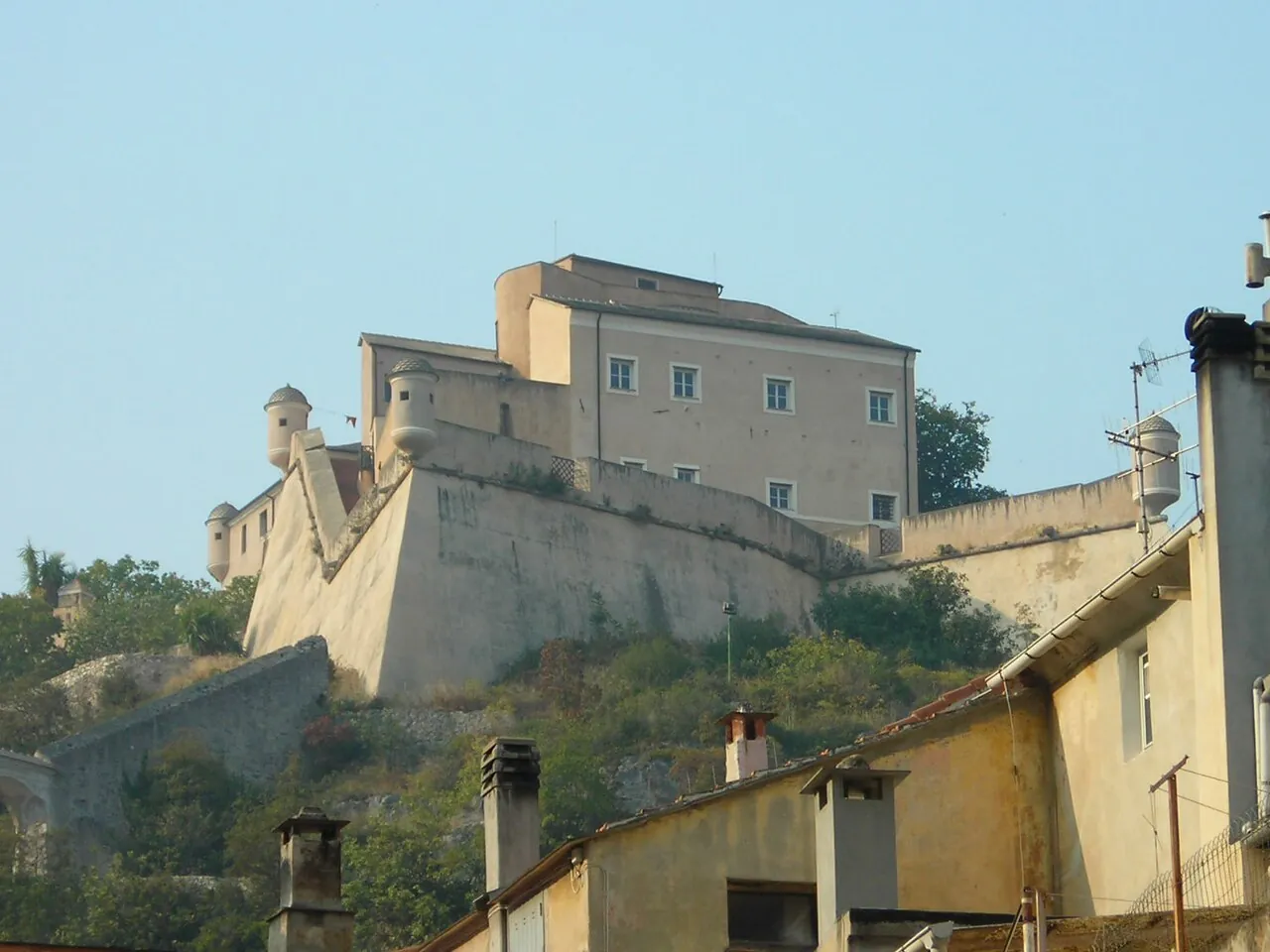
A medieval village enclosed by the walls of the Del Carretto marquises, below the ruins of Castel Gavone. All around are limestone crags famous among climbers and trails for mountain biking.
In the itineraries
Get directions ↗OpenStreetMap ↗
Saved. You'll find everything in My trip, where you can split it into days and see it on the map.
Saved on this device: you can open it even without a connection. All your saved pages are in Offline guides.
Weather forecast
The forecast for the next 7 days at this spot: sky, temperatures, rain and wind, wave height and sea temperature.
Forecast by Open-Meteo (CC BY 4.0), from the models of national weather services. Your browser downloads it directly from Open-Meteo, and only when you ask. In the mountains and at sea the weather changes quickly: check the official forecast as well before you set off.
Getting there
- By train. The nearest station is Finale Ligure Marina station, 900 m away (about 15 minutes on foot). Alternatively: Borgio Verezzi station, 3.1 km away.
- By air. The nearest airport is Genoa Airport (GOA), about 49 km away; with more flights, Turin Airport (TRN) is about 126 km away.
- Parking. There are many signposted car parks within a kilometre; the nearest is 350 m away.
- ZTL. Many Italian historic centres are limited traffic zones (ZTL) monitored by cameras: if you arrive by car, leave it outside the centre and check opening times and permits on the town council's website (your hotel may be able to register your plate).
Stations, ports, airports and car parks from OpenStreetMap (© OpenStreetMap contributors, ODbL); distances as the crow flies. Timetables and connections change: check them before you travel.
Climate month by month
The most pleasant months for weather are from May to October, with average highs between 18 and 29 °C. The wettest month is November (about 100 mm), the driest July. The sea is above 22 °C from June to September, peaking at 26 °C in August.
| Month | Temperature | High / low | Rain mm | Sea |
|---|---|---|---|---|
| Jan | from 7 to 13 °C | 13° 7° | 39 | 14° |
| Feb | from 7 to 13 °C | 13° 7° | 57 | 14° |
| Mar | from 9 to 15 °C | 15° 9° | 60 | 14° |
| Apr | from 11 to 16 °C | 16° 11° | 48 | 15° |
| May | from 15 to 20 °C | 20° 15° | 64 | 18° |
| Jun | from 20 to 24 °C | 24° 20° | 43 | 22° |
| Jul | from 22 to 28 °C | 28° 22° | 31 | 25° |
| Aug | from 23 to 28 °C | 28° 23° | 36 | 26° |
| Sep | from 19 to 25 °C | 25° 19° | 50 | 24° |
| Oct | from 15 to 21 °C | 21° 15° | 85 | 21° |
| Nov | from 11 to 17 °C | 17° 11° | 100 | 18° |
| Dec | from 8 to 14 °C | 14° 8° | 57 | 16° |
Averages for 2015–2024, estimated for an altitude of 104 m. Air: NASA POWER (MERRA-2 reanalysis), corrected for the altitude of the place; rain: average monthly total; sea: surface temperature from NOAA OISST. These are indicative values: the weather on any given day can be very different, so always check the forecast before you go.
On foot and on the water, nearby
- ★ Sentiero del Pellegrino, Varigotti–NoliTrail · T · 4.9 km · +430 m · 2–2.5 hours · 5 km
- Bay of the SaracensWater sports · Snorkelling, SUP · Easy · 6 km
- ★ Bergeggi IslandWater sports · Snorkelling, Kayaking, SUP · Easy when the sea is calm · 11 km
- ★ Bergeggi sea caveWater sports · Kayaking, SUP · Easy · 11 km