The Earth Pyramids of Zone
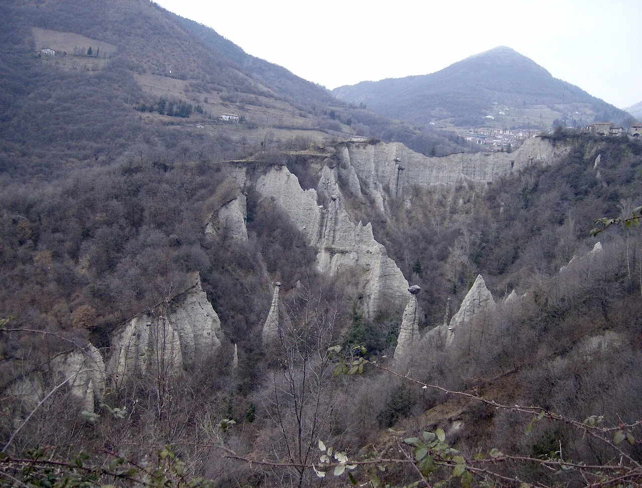
A short loop above Lake Iseo among dozens of earth columns up to 30 metres high, each with a boulder balanced on top.
- Difficulty
- E Hiking
- Length
- 2.1 km
- Elevation gain
- +170 m / −180 m
- Time
- 1–1.5 hours
- Route
- Loop
- Altitude
- 480–676 m
- Season
- Spring Summer Autumn Winter
Download the GPXDirections to the start ↗
Saved. You'll find everything in My trip, where you can split it into days and see it on the map.
Saved on this device: you can open it even without a connection. All your saved pages are in Offline guides.
The topographic map loads OpenTopoMap tiles (an external server) only when you open it.
The story
The pyramids formed through erosion of a deposit left by the Valcamonica glacier: where a boulder shielded the ground from the rain, the earth beneath stayed standing, forming a column. When the boulder falls, the pyramid wears away within a few years. They are protected by a nature reserve.
Why go
Because it is one of the strangest geological landscapes in Italy, a few minutes from the lake, and you can see it in an hour.
Practical information
- Start
- Cislano (Zone)
- Finish
- Loop
- Best time
- All year round
- Parking
- Car park in Cislano, near the church of San Giorgio.
- By public transport
- Bus from Marone, with few runs.
- Water
- Fountain in Cislano.
- Shade
- Alternating woods and open stretches.
- Huts and refreshments
- None.
- With children
- Yes: short and spectacular for children.
Weather at the start
The forecast for the next 7 days at this spot: sky, temperatures, rain and wind.
Forecast by Open-Meteo (CC BY 4.0), from the models of national weather services. Your browser downloads it directly from Open-Meteo, and only when you ask. In the mountains and at sea the weather changes quickly: check the official forecast as well before you set off.
What to see on the route and nearby
After the hike, into the water
More hikes in Lombardy
- 1Sentiero del Viandante, Lierna–VarennaE 7.4 km · +580 m · 3–3.5 hours · point to point
- 2★ Codera, the village you can only reach on footE 6.2 km · +570 m · 3–3.5 hours · out and back
- 4★ Monte Isola, the climb to the Madonna della CeriolaE 5.5 km · +470 m · 2.5–3 hours · out and back
- 5★ The Forni glacier trailE 4.1 km · +460 m · 3 hours · point to point
- 6Lake Como Greenway, from Colonno to CadenabbiaT 11 km · +170 m · 3–3.5 hours · point to point
- 7The Via Sacra of the Sacred Mountain of VareseT 3.4 km · +200 m · 1.5–2 hours round trip · out and back
- 8Val di Mello to Cascina PianaT 6.8 km · +160 m · 2.5 hours round trip · out and back
- 9Rifugio Curò and Lago del Barbellino from ValbondioneE 9.8 km · +960 m · 5–5.5 hours round trip · out and back
- 10Laghi Gemelli from CaronaE 10.6 km · +860 m · 5 hours round trip · out and back
- 11Corni di Canzo: from Fonti di Gajum to Rifugio SEVE 10.3 km · +770 m · 4.5 hours round trip · out and back
- 12Lago Palù from San Giuseppe in ValmalencoE 7.9 km · +520 m · 3–3.5 hours round trip · out and back
Routes © OpenStreetMap contributors (ODbL), via Waymarked Trails and BRouter; elevations from a digital terrain model. Times and elevation gains are indicative: waymarks on the ground and closure orders always take precedence.