Isola Comacina
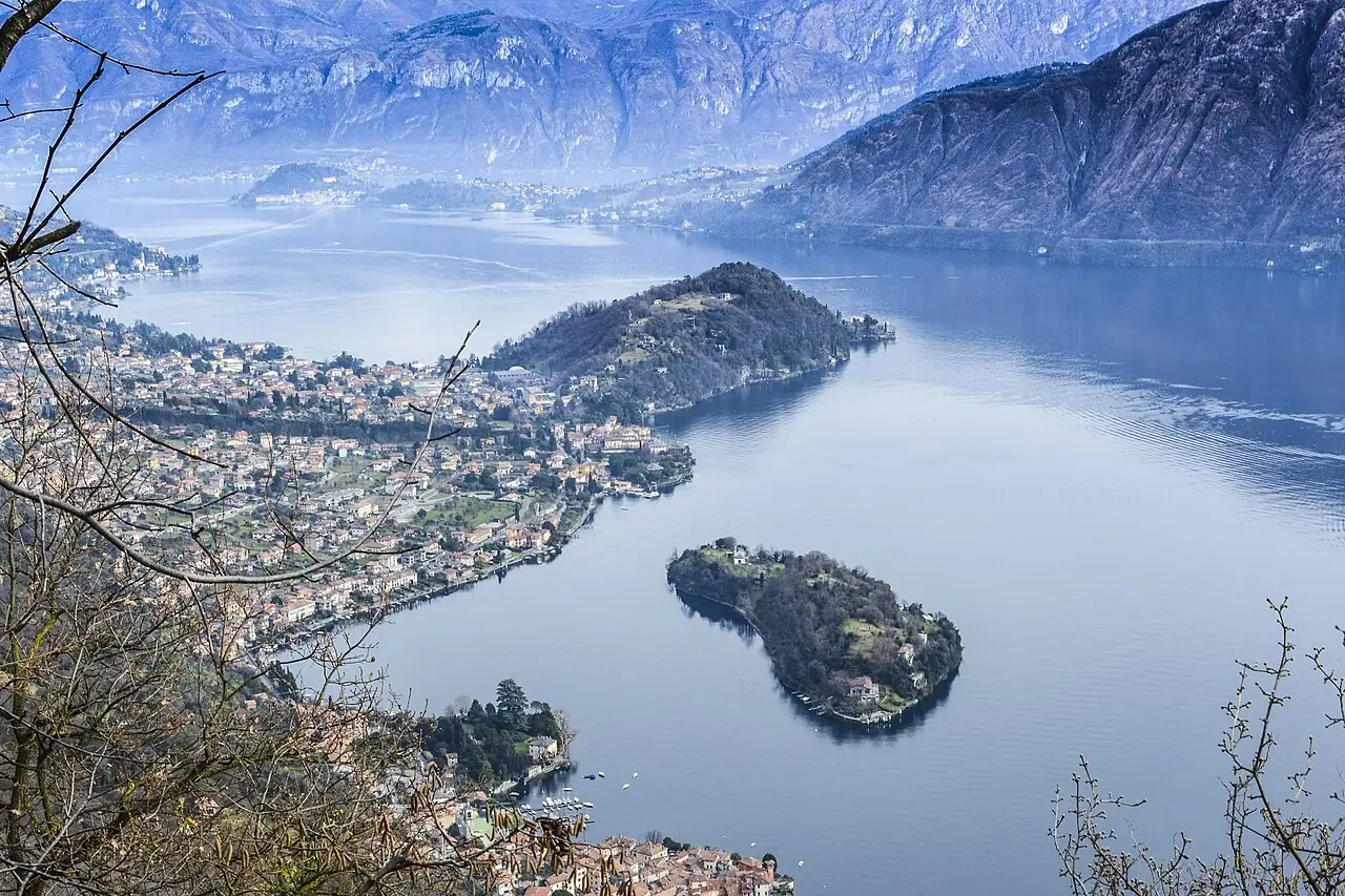
Lake Como's only island, covered in woods and the ruins of Romanesque churches, with a single inn.
The story
In the Middle Ages the island was fortified and populated, allied with Milan. In 1169 the people of Como destroyed it, and tradition says the bishop laid a curse on it: no more bells, no stone upon stone and no innkeeper on the island, on pain of a violent death. In the 20th century the island was bequeathed to the King of Belgium, who returned it to Italy as a retreat for artists of the Brera Academy. The inn that opened in 1947 ends every lunch with the 'fire ritual', a flambé coffee meant to keep the curse at bay.
Why go
A boat trip of a few minutes, ruins among the olive trees and a story to tell.
In the itineraries
Get directions ↗OpenStreetMap ↗
Saved. You'll find everything in My trip, where you can split it into days and see it on the map.
Saved on this device: you can open it even without a connection. All your saved pages are in Offline guides.
Weather forecast
The forecast for the next 7 days at this spot: sky, temperatures, rain and wind.
Forecast by Open-Meteo (CC BY 4.0), from the models of national weather services. Your browser downloads it directly from Open-Meteo, and only when you ask. In the mountains and at sea the weather changes quickly: check the official forecast as well before you set off.
Getting there
- By train. The nearest station is Lierna station, 7.5 km away. Alternatively: Fiumelatte station, 7.6 km away. From the station you need a bus, a taxi or a car.
- By sea. The nearest ferry terminal is Lenno, 1 km away.
- By air. The nearest airport is Bergamo Orio al Serio Airport (BGY), about 50 km away.
- Parking. There are 3 signposted car parks within a kilometre; the nearest is 900 m away, paid.
Stations, ports, airports and car parks from OpenStreetMap (© OpenStreetMap contributors, ODbL); distances as the crow flies. Timetables and connections change: check them before you travel.
Climate month by month
The most pleasant months for weather are April and from June to September, with average highs between 18 and 29 °C. The wettest month is May (about 156 mm), the driest January.
| Month | Temperature | High / low | Rain mm |
|---|---|---|---|
| Jan | from 1 to 8 °C | 8° 1° | 52 |
| Feb | from 3 to 10 °C | 10° 3° | 69 |
| Mar | from 6 to 14 °C | 14° 6° | 75 |
| Apr | from 9 to 18 °C | 18° 9° | 94 |
| May | from 14 to 21 °C | 21° 14° | 156 |
| Jun | from 19 to 26 °C | 26° 19° | 138 |
| Jul | from 21 to 29 °C | 29° 21° | 109 |
| Aug | from 21 to 28 °C | 28° 21° | 122 |
| Sep | from 16 to 24 °C | 24° 16° | 116 |
| Oct | from 12 to 20 °C | 20° 12° | 150 |
| Nov | from 7 to 14 °C | 14° 7° | 103 |
| Dec | from 3 to 9 °C | 9° 3° | 70 |
Averages for 2015–2024, estimated for an altitude of 190 m. Air: NASA POWER (MERRA-2 reanalysis), corrected for the altitude of the place; rain: average monthly total. These are indicative values: the weather on any given day can be very different, so always check the forecast before you go.
On foot and on the water, nearby
- Lake Como Greenway, from Colonno to CadenabbiaTrail · T · 11 km · +170 m · 3–3.5 hours · 4 km
- Sentiero del Viandante, Lierna–VarennaTrail · E · 7.4 km · +580 m · 3–3.5 hours · 8 km
- Corni di Canzo: from Fonti di Gajum to Rifugio SEVTrail · E · 10.3 km · +770 m · 4.5 hours round trip · 15 km