Piuro and the Acquafraggia
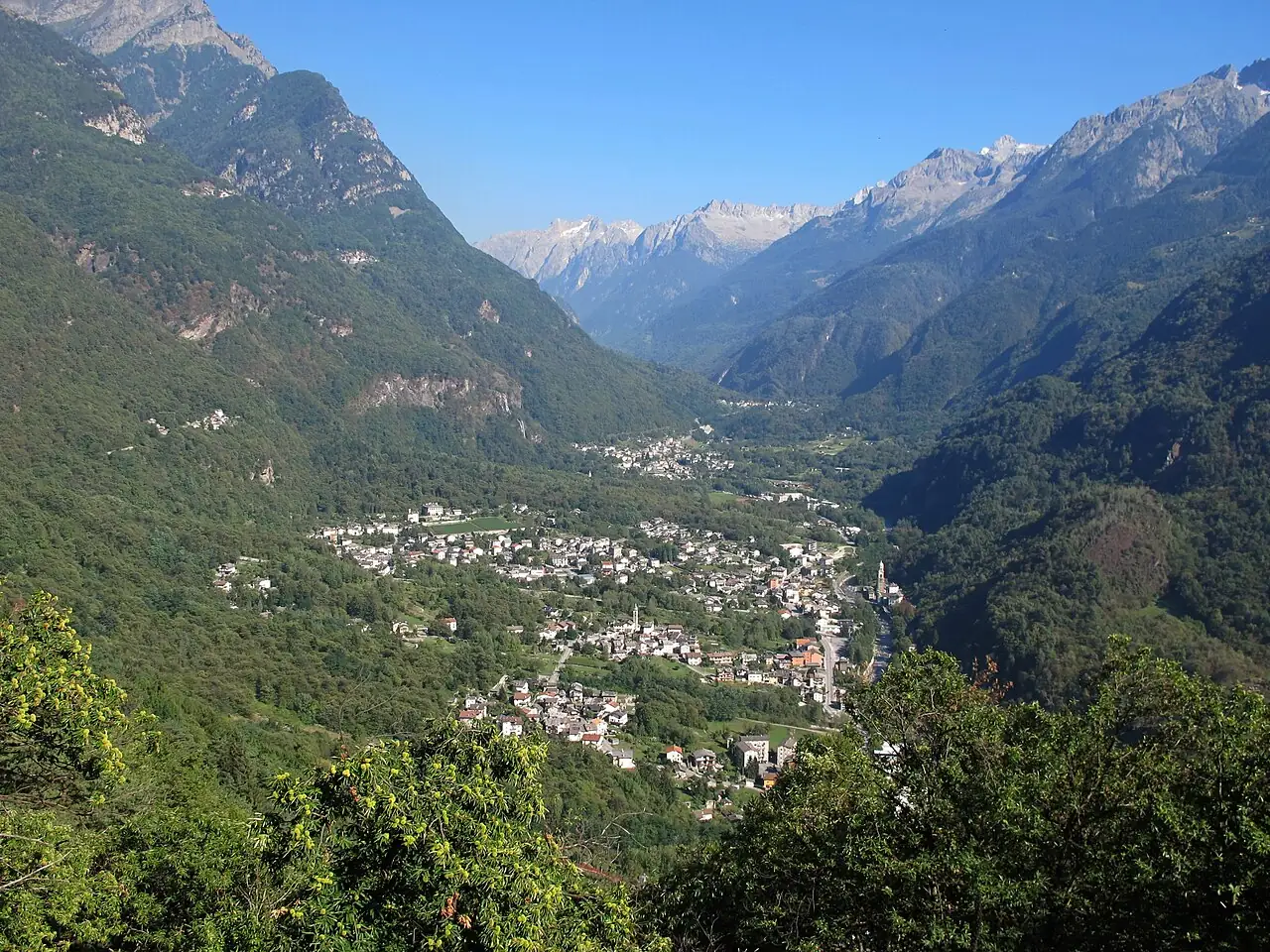
A valley above Chiavenna with a Renaissance palace, the ruins of a buried town and a waterfall leaping over the rocks.
The story
Piuro was a very wealthy town, trading silk and soapstone with half of Europe. On the evening of 4 September 1618 a landslide broke away from Monte Conto and buried it in minutes along with almost all its inhabitants, perhaps a thousand people. Palazzo Vertemate Franchi survived, with its inlaid wooden rooms and its orchard, and can be visited today. Nearby, the Acquafraggia waterfalls were already described by Leonardo da Vinci.
Why go
A 'Pompeii of the Alps' story, a secret palace and a spectacular waterfall a stone's throw from Switzerland.
In the itineraries
Get directions ↗OpenStreetMap ↗
Saved. You'll find everything in My trip, where you can split it into days and see it on the map.
Saved on this device: you can open it even without a connection. All your saved pages are in Offline guides.
Weather forecast
The forecast for the next 7 days at this spot: sky, temperatures, rain and wind.
Forecast by Open-Meteo (CC BY 4.0), from the models of national weather services. Your browser downloads it directly from Open-Meteo, and only when you ask. In the mountains and at sea the weather changes quickly: check the official forecast as well before you set off.
Getting there
- By train. The nearest station is Chiavenna station, 2.3 km away (about 40 minutes on foot). Alternatively: Prata Camportaccio station, 3.5 km away.
- By air. The nearest airport is Bergamo Orio al Serio Airport (BGY), about 75 km away.
- Parking. There are many signposted car parks within a kilometre; the nearest is 150 m away, paid.
Stations, ports, airports and car parks from OpenStreetMap (© OpenStreetMap contributors, ODbL); distances as the crow flies. Timetables and connections change: check them before you travel.
Climate month by month
The most pleasant months for weather are from September to October, with average highs between 18 and 29 °C. From January to February night-time temperatures drop below freezing on average. The wettest month is August (about 163 mm), the driest February.
| Month | Temperature | High / low | Rain mm |
|---|---|---|---|
| Jan | from -3 to 6 °C | 6° -3° | 67 |
| Feb | from -1 to 8 °C | 8° -1° | 58 |
| Mar | from 1 to 10 °C | 10° 1° | 81 |
| Apr | from 6 to 14 °C | 14° 6° | 98 |
| May | from 11 to 20 °C | 20° 11° | 151 |
| Jun | from 16 to 26 °C | 26° 16° | 160 |
| Jul | from 18 to 28 °C | 28° 18° | 144 |
| Aug | from 18 to 27 °C | 27° 18° | 163 |
| Sep | from 14 to 23 °C | 23° 14° | 127 |
| Oct | from 10 to 19 °C | 19° 10° | 137 |
| Nov | from 4 to 12 °C | 12° 4° | 88 |
| Dec | from 0 to 8 °C | 8° 0° | 76 |
Averages for 2015–2024, estimated for an altitude of 419 m. Air: NASA POWER (MERRA-2 reanalysis), corrected for the altitude of the place; rain: average monthly total. These are indicative values: the weather on any given day can be very different, so always check the forecast before you go.
On foot and on the water, nearby
- ★ Canyoning in the Val BodengoWater sports · Canyoning · With a guide for beginners; experts with their own equipment · 11 km
- ★ Codera, the village you can only reach on footTrail · E · 6.2 km · +570 m · 3–3.5 hours · 12 km