San Vincenzo al Volturno
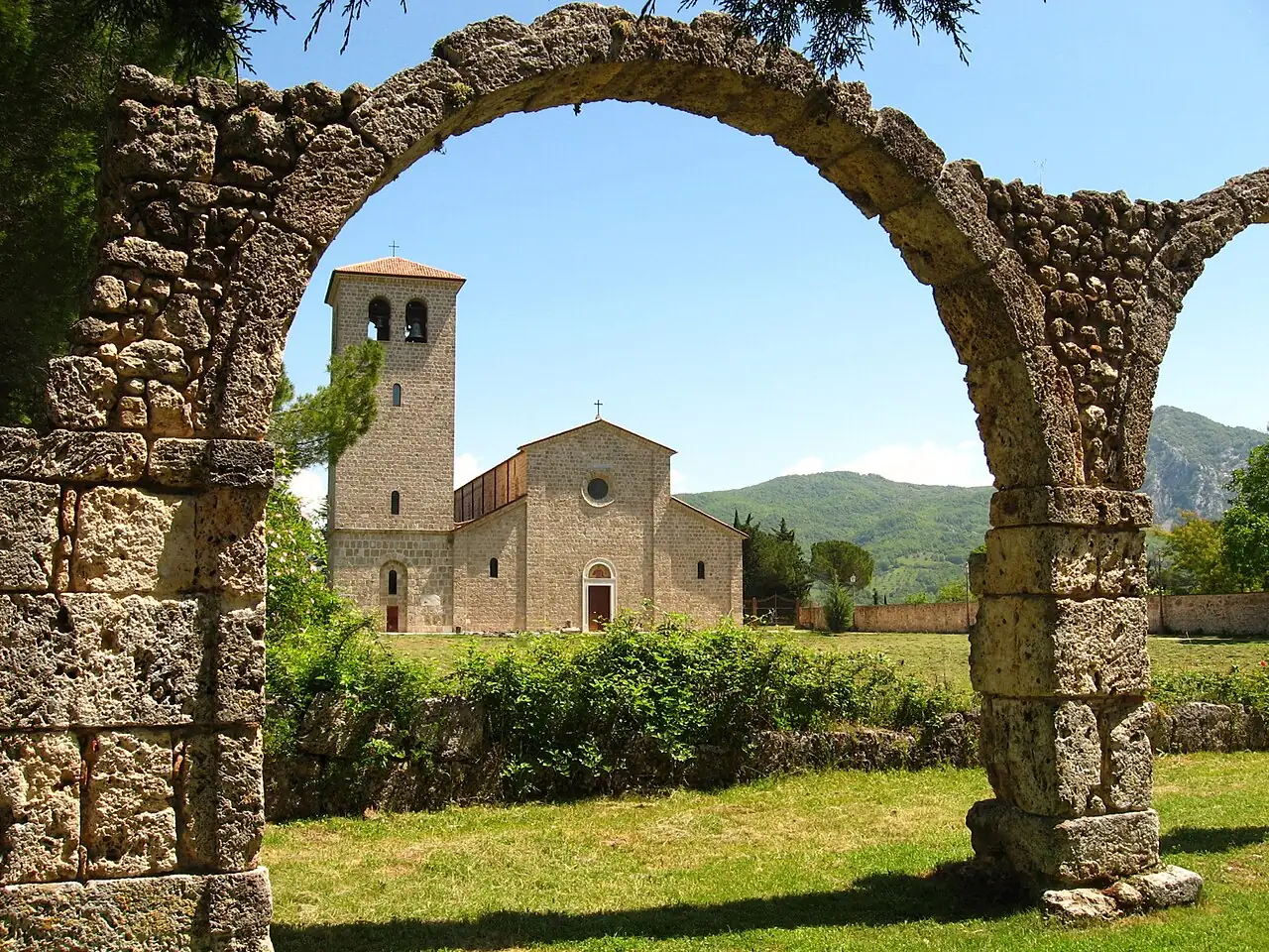
The ruins of a great medieval abbey at the source of the Volturno, with a crypt frescoed in the 9th century.
The story
Founded in the early 8th century by three nobles from Benevento, by the 9th century it was one of the richest abbeys in Europe, a small town with hundreds of monks and workshops of glassmakers and goldsmiths. In 881 it was sacked and destroyed by the Saracens. The crypt of Abbot Epiphanius, frescoed between 824 and 842, holds one of the most important early medieval painting cycles in Italy.
Why go
An extraordinary discovery in a green valley, on the edge of the Abruzzo, Lazio and Molise National Park.
In the itineraries
Get directions ↗OpenStreetMap ↗
Saved. You'll find everything in My trip, where you can split it into days and see it on the map.
Saved on this device: you can open it even without a connection. All your saved pages are in Offline guides.
Weather forecast
The forecast for the next 7 days at this spot: sky, temperatures, rain and wind.
Forecast by Open-Meteo (CC BY 4.0), from the models of national weather services. Your browser downloads it directly from Open-Meteo, and only when you ask. In the mountains and at sea the weather changes quickly: check the official forecast as well before you set off.
Getting there
- By train. The nearest station is Alfedena-Scontrone station, 10.4 km away. Alternatively: Isernia station, 13.6 km away. From the station you need a bus, a taxi or a car.
- By air. The nearest airport is Naples Capodichino Airport (NAP), about 87 km away.
- Parking. There are 3 signposted car parks within a kilometre; the nearest is 500 m away.
Stations, ports, airports and car parks from OpenStreetMap (© OpenStreetMap contributors, ODbL); distances as the crow flies. Timetables and connections change: check them before you travel.
Climate month by month
The most pleasant months for weather are from May to June and from September to October, with average highs between 18 and 29 °C. From July to August it is hot: average highs exceed 30 °C. The wettest month is November (about 108 mm), the driest July.
| Month | Temperature | High / low | Rain mm |
|---|---|---|---|
| Jan | from 1 to 9 °C | 9° 1° | 68 |
| Feb | from 3 to 11 °C | 11° 3° | 50 |
| Mar | from 3 to 13 °C | 13° 3° | 55 |
| Apr | from 6 to 17 °C | 17° 6° | 41 |
| May | from 11 to 21 °C | 21° 11° | 59 |
| Jun | from 16 to 28 °C | 28° 16° | 37 |
| Jul | from 19 to 33 °C | 33° 19° | 31 |
| Aug | from 19 to 32 °C | 32° 19° | 39 |
| Sep | from 14 to 26 °C | 26° 14° | 70 |
| Oct | from 11 to 21 °C | 21° 11° | 72 |
| Nov | from 7 to 15 °C | 15° 7° | 108 |
| Dec | from 3 to 11 °C | 11° 3° | 48 |
Averages for 2015–2024, estimated for an altitude of 553 m. Air: NASA POWER (MERRA-2 reanalysis), corrected for the altitude of the place; rain: average monthly total. These are indicative values: the weather on any given day can be very different, so always check the forecast before you go.