Scala Santa, from Macchia to Monte Sant'Angelo
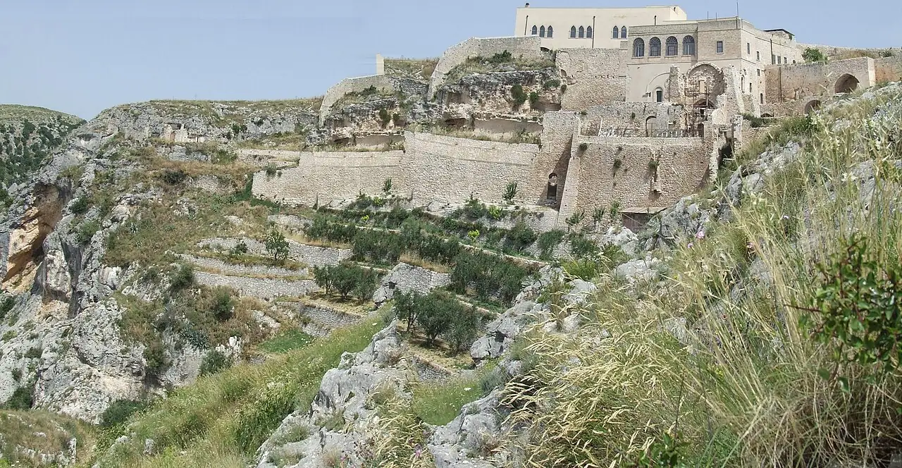
A stepped mule track, partly cut into the rock, climbs more than 500 metres from the coastal plain towards Monte Sant'Angelo, with the view over the Gulf of Manfredonia widening at every bend.
- Difficulty
- E Hiking
- Length
- 3.3 km
- Elevation gain
- +510 m / −10 m
- Time
- 1.5–2 hours uphill
- Route
- Point to point
- Altitude
- 165–678 m
- Season
- Spring Autumn Winter
Download the GPXDirections to the start ↗
Saved. You'll find everything in My trip, where you can split it into days and see it on the map.
Saved on this device: you can open it even without a connection. All your saved pages are in Offline guides.
The topographic map loads OpenTopoMap tiles (an external server) only when you open it.
The story
For centuries it was the route of pilgrims who arrived by sea and climbed to the cave where, according to tradition, the Archangel Michael appeared at the end of the 5th century. Kings, popes, saints and crusaders bound for the Holy Land passed this way. The sanctuary is part of the UNESCO site «The Longobards in Italy».
Why go
Because you reach the sanctuary like medieval pilgrims, on foot, climbing up from the sea.
Practical information
- Start
- Macchia (Monte Sant'Angelo), near the coast
- Finish
- Monte Sant'Angelo, sanctuary of St Michael
- Best time
- October–May
- Parking
- Car park at Macchia, on the Manfredonia–Mattinata road.
- By public transport
- Bus from Manfredonia to Monte Sant'Angelo; walk up and come back by bus.
- Water
- None along the trail: carry at least a litre and a half.
- Shade
- Very little.
- Huts and refreshments
- None: bars and restaurants in Monte Sant'Angelo.
- With children
- With fit teenagers: a steep, unrelenting climb on stone steps.
Weather at the start
The forecast for the next 7 days at this spot: sky, temperatures, rain and wind.
Forecast by Open-Meteo (CC BY 4.0), from the models of national weather services. Your browser downloads it directly from Open-Meteo, and only when you ask. In the mountains and at sea the weather changes quickly: check the official forecast as well before you set off.
What to see on the route and nearby
More hikes in Puglia
- 2From Otranto to the Punta Palascìa lighthouseT 6.3 km · +80 m · 1.5–2 hours · point to point
- 3★ The Cipolliane Trail, from Novaglie to the CioloT 5.1 km · +70 m · 2 hours round trip, including the caves · out and back
Routes © OpenStreetMap contributors (ODbL), via Waymarked Trails and BRouter; elevations from a digital terrain model. Times and elevation gains are indicative: waymarks on the ground and closure orders always take precedence.