Necropolis of Anghelu Ruju
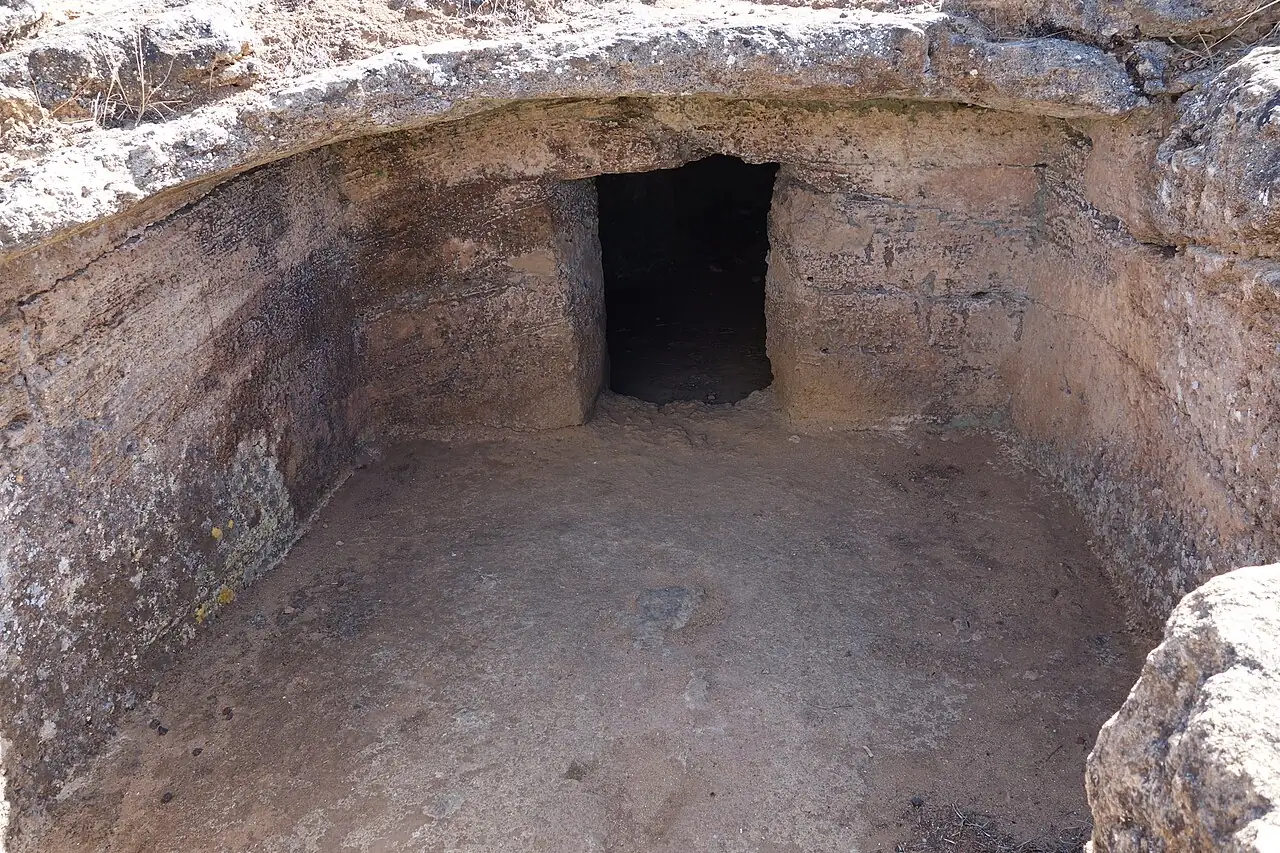
Dozens of «domus de janas», the fairies' houses: tombs carved into the rock, with carvings in the shape of bull's horns. One of the largest pre-nuragic necropolises.
The story
The necropolis was discovered in 1903 while digging to plant the vineyards of the Sella & Mosca estate, and was excavated soon after by the archaeologist Antonio Taramelli. The tombs, carved into the rock more than five thousand years ago, are the «domus de janas», the fairies' houses of Sardinian tradition: some still have bull's horns carved on their walls, a symbol of strength and fertility.
Why go
You go down into the tombs on your own two feet and see the carvings up close, ten minutes from Alghero and the sea.
In the itineraries
Get directions ↗OpenStreetMap ↗
Saved. You'll find everything in My trip, where you can split it into days and see it on the map.
Saved on this device: you can open it even without a connection. All your saved pages are in Offline guides.
Weather forecast
The forecast for the next 7 days at this spot: sky, temperatures, rain and wind.
Forecast by Open-Meteo (CC BY 4.0), from the models of national weather services. Your browser downloads it directly from Open-Meteo, and only when you ask. In the mountains and at sea the weather changes quickly: check the official forecast as well before you set off.
Getting there
- By train. The nearest station is Mamuntanas station, 3.7 km away. Alternatively: Olmedo station, 4.7 km away. From the station you need a bus, a taxi or a car.
- By air. The nearest airport is Alghero Airport (AHO), about 3 km away; with more flights, Olbia-Costa Smeralda Airport (OLB) is about 105 km away.
- Parking. The nearest public car park is 50 m away, free.
Stations, ports, airports and car parks from OpenStreetMap (© OpenStreetMap contributors, ODbL); distances as the crow flies. Timetables and connections change: check them before you travel.
Climate month by month
The most pleasant months for weather are from May to November, with average highs between 18 and 29 °C. The wettest month is November (about 110 mm), the driest July.
| Month | Temperature | High / low | Rain mm |
|---|---|---|---|
| Jan | from 12 to 14 °C | 14° 12° | 66 |
| Feb | from 12 to 14 °C | 14° 12° | 63 |
| Mar | from 12 to 15 °C | 15° 12° | 50 |
| Apr | from 14 to 17 °C | 17° 14° | 47 |
| May | from 17 to 19 °C | 19° 17° | 43 |
| Jun | from 21 to 23 °C | 23° 21° | 27 |
| Jul | from 24 to 26 °C | 26° 24° | 5 |
| Aug | from 24 to 27 °C | 27° 24° | 18 |
| Sep | from 22 to 25 °C | 25° 22° | 41 |
| Oct | from 19 to 22 °C | 22° 19° | 64 |
| Nov | from 16 to 18 °C | 18° 16° | 110 |
| Dec | from 13 to 16 °C | 16° 13° | 79 |
Averages for 2015–2024, estimated for an altitude of 20 m. Air: NASA POWER (MERRA-2 reanalysis), corrected for the altitude of the place; rain: average monthly total. These are indicative values: the weather on any given day can be very different, so always check the forecast before you go.
Nearby
- Le Bombarde and Il LazzarettoBeach · 8 km as the crow flies
- AlgheroTown · 8 km as the crow flies
- Porto FerroBeach · 12 km as the crow flies
- Capo Caccia and Neptune's GrottoNature · 16 km as the crow flies
- ★ Altar of Monte d'AccoddiHistory and art · 20 km as the crow flies
- SassariTown · 22 km as the crow flies