Mozia
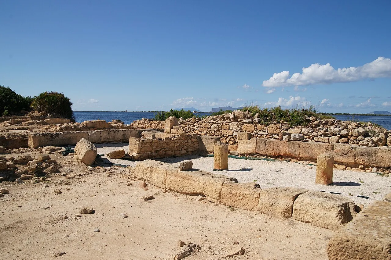
A small island in the Stagnone lagoon, opposite the Marsala salt pans, with the ruins of a Phoenician city and a museum.
The story
Motya was a thriving Phoenician colony until Dionysius of Syracuse destroyed it in 397 BC. In the early 20th century the island was bought by the Englishman Joseph Whitaker, of the family of Marsala wine producers, who had its ruins excavated. In 1979 the Motya Charioteer was found here, a Greek marble statue among the finest of antiquity. A submerged Phoenician road still links the island to the coast.
Why go
A little boat from the salt pans, the windmills, the flamingos and a Greek masterpiece in a tiny museum: one of the loveliest afternoons in Sicily.
In the itineraries
Get directions ↗OpenStreetMap ↗
Saved. You'll find everything in My trip, where you can split it into days and see it on the map.
Saved on this device: you can open it even without a connection. All your saved pages are in Offline guides.
Weather forecast
The forecast for the next 7 days at this spot: sky, temperatures, rain and wind, wave height and sea temperature.
Forecast by Open-Meteo (CC BY 4.0), from the models of national weather services. Your browser downloads it directly from Open-Meteo, and only when you ask. In the mountains and at sea the weather changes quickly: check the official forecast as well before you set off.
Getting there
- By train. The nearest station is Mozia-Birgi station, 3.3 km away. Alternatively: Spagnuola station, 3.5 km away. From the station you need a bus, a taxi or a car.
- By sea. The nearest ferry terminal is Mozia, 300 m away.
- By air. The nearest airport is Trapani-Birgi Airport (TPS), about 5 km away; with more flights, Palermo Falcone e Borsellino Airport (PMO) is about 65 km away.
- Parking. The nearest public car park is 1.5 km away.
Stations, ports, airports and car parks from OpenStreetMap (© OpenStreetMap contributors, ODbL); distances as the crow flies. Timetables and connections change: check them before you travel.
Climate month by month
The most pleasant months for weather are from May to November, with average highs between 18 and 29 °C. The wettest month is October (about 70 mm), the driest July. The sea is above 22 °C from June to October, peaking at 27 °C in August.
| Month | Temperature | High / low | Rain mm | Sea |
|---|---|---|---|---|
| Jan | from 12 to 15 °C | 15° 12° | 42 | 16° |
| Feb | from 11 to 15 °C | 15° 11° | 47 | 15° |
| Mar | from 12 to 16 °C | 16° 12° | 41 | 15° |
| Apr | from 14 to 17 °C | 17° 14° | 28 | 16° |
| May | from 17 to 20 °C | 20° 17° | 44 | 18° |
| Jun | from 21 to 24 °C | 24° 21° | 17 | 22° |
| Jul | from 25 to 28 °C | 28° 25° | 6 | 25° |
| Aug | from 26 to 29 °C | 29° 26° | 19 | 27° |
| Sep | from 23 to 26 °C | 26° 23° | 47 | 25° |
| Oct | from 20 to 23 °C | 23° 20° | 70 | 22° |
| Nov | from 17 to 20 °C | 20° 17° | 66 | 20° |
| Dec | from 13 to 16 °C | 16° 13° | 42 | 17° |
Averages for 2015–2024, estimated for an altitude of 8 m. Air: NASA POWER (MERRA-2 reanalysis), corrected for the altitude of the place; rain: average monthly total; sea: surface temperature from NOAA OISST. These are indicative values: the weather on any given day can be very different, so always check the forecast before you go.
On foot and on the water, nearby
- Kitesurfing at the Stagnone di MarsalaWater sports · Windsurfing and kitesurfing · All levels, with a school · less than 1 km
- Favignana and MarettimoWater sports · Snorkelling, Scuba diving, Kayaking · Beginners (snorkelling), basic certification (diving) · 13 km