From Pederù to Rifugio Fanes and Lago di Limo
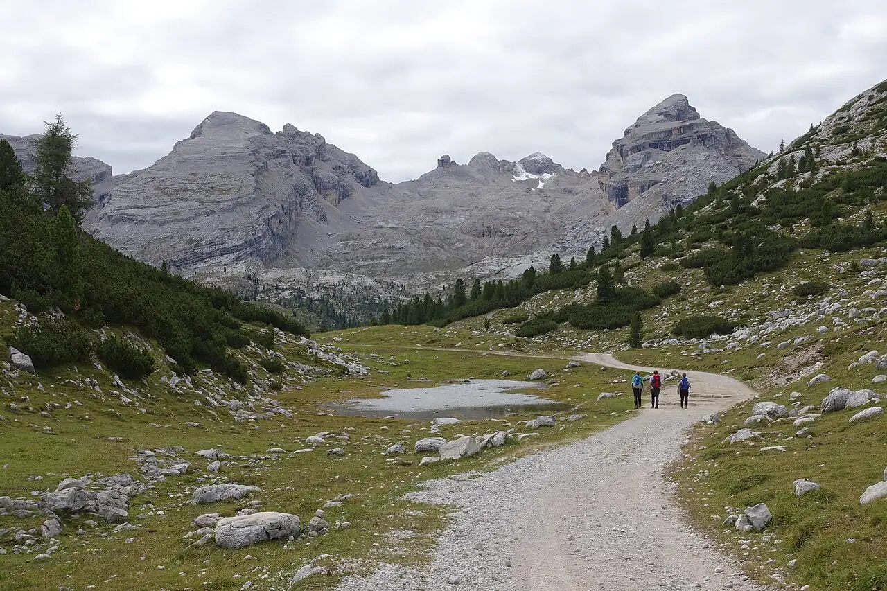
A climb on a military road to the Fanes plateau, a world of pastures, small lakes and pale rock in the Fanes-Senes-Braies Natural Park.
- Difficulty
- E Hiking
- Length
- 12.5 km
- Elevation gain
- +630 m / −630 m
- Time
- 4.5–5 hours round trip
- Route
- Out and back
- Altitude
- 1537–2170 m
- Season
- Summer Autumn
Download the GPXDirections to the start ↗
Saved. You'll find everything in My trip, where you can split it into days and see it on the map.
Saved on this device: you can open it even without a connection. All your saved pages are in Offline guides.
The topographic map loads OpenTopoMap tiles (an external server) only when you open it.
The story
Fanes is the setting of the most important legend in Ladin culture: the 'Kingdom of Fanes', a people allied with the marmots who, according to tradition, still sleep beneath the mountains awaiting their return.
Why go
Because in half a day you reach one of the most beautiful and unspoilt plateaus in the Dolomites.
Practical information
- Start
- Rifugio Pederù, at the head of the Rudo valley (San Vigilio di Marebbe)
- Finish
- Lago di Limo, beyond Rifugio Fanes; back the same way
- Best time
- June–October
- Parking
- At Pederù (pay).
- By public transport
- Summer buses from San Vigilio to Pederù; from Pederù, off-road taxis up to the huts.
- Water
- At the Fanes and Lavarella huts.
- Shade
- Little: the road climbs through an open valley.
- Huts and refreshments
- Fanes, Lavarella.
- With children
- Yes, on a dirt road; the youngest will need the taxi.
Weather at the start
The forecast for the next 7 days at this spot: sky, temperatures, rain and wind.
Forecast by Open-Meteo (CC BY 4.0), from the models of national weather services. Your browser downloads it directly from Open-Meteo, and only when you ask. In the mountains and at sea the weather changes quickly: check the official forecast as well before you set off.
What to see on the route and nearby
- Val BadiaOn the route
- Lago di Braies7 km from the start
- Plan de Corones and the Messner museum13 km from the start
More hikes in Trentino-South Tyrol
- 1The Adolf Munkel trail below the OdleE 5.8 km · +190 m · 3–3.5 hours · point to point
- 2Around Lago di BraiesT 3.5 km · +230 m · 1–1.5 hours · loop
- 3★ The Ponale roadT 5.3 km · +340 m · 2 hours round trip · out and back
- 4★ The Lagundo WaalwegT 4.3 km · +200 m · 1.5–2 hours · point to point
- 5★ From Tenno to the village of CanaleT 3.7 km · +200 m · 1 hour · out and back
- 6From Seceda to Col Raiser via PieralongiaE 3.8 km · +30 m · 1.5–2 hours · point to point
- 7The Vallunga from SelvaT 11.7 km · +260 m · 3–3.5 hours round trip · out and back
- 8Alpe di Siusi: from Compaccio to SaltriaT 5.8 km · +40 m · 1.5–2 hours · point to point
- 9Around the Sassolungo and SassopiattoEE 17.3 km · +900 m · 6–7 hours · loop
- 10Val Venegia to Baita SegantiniE 12.7 km · +510 m · 4–4.5 hours round trip · out and back
- 11From the Rolle Pass to Baita Segantini, snowshoes tooT 4 km · +200 m · 1.5–2 hours round trip · out and back
- 12Val Genova: from the Nardis Falls to Malga BedoleT 12.5 km · +670 m · 4–4.5 hours · point to point
- 13From Vallesinella to Rifugio TuckettE 7.7 km · +680 m · 4.5–5 hours round trip · out and back
- 14Picco di Vallandro from Prato PiazzaE 8.4 km · +820 m · 4.5–5 hours round trip · out and back
- 15From Val Fiscalina to Rifugio Locatelli, facing the Tre CimeE 13.1 km · +950 m · 5.5–6 hours round trip · out and back
- 16Val Fiscalina to Rifugio FondovalleT 3.5 km · +70 m · 1–1.5 hours round trip · out and back
- 17★ From San Leonardo to Santa Croce via OiesE 9.6 km · +660 m · 4–4.5 hours round trip · out and back
- 19Saènt Waterfalls in Val di RabbiE 5.7 km · +480 m · 3–3.5 hours round trip · out and back
- 20★ Lago di Erdemolo in the Mòcheni valleyE 6.4 km · +470 m · 3 hours round trip · out and back
- 21★ Forra del Lupo, the Serrada trenchE 7.8 km · +400 m · 3–3.5 hours round trip · out and back
- 22Partschins Waterfall from the villageE 5.6 km · +450 m · 2.5–3 hours round trip · out and back
- 23Around Lago di TovelT 3.3 km · +20 m · 1–1.5 hours · loop
- 24Around Lago di AnterselvaT 3.7 km · +50 m · 1–1.5 hours · loop
- 25Path around Lago di CarezzaT 4 km · +140 m · 1–1.5 hours · loop
- 26The Tappeiner promenade in MeranoT 2.9 km · +220 m · 1–1.5 hours · point to point
- 27Viel dal Pan, the bread pathE 6.8 km · +220 m · 2.5–3 hours · point to point
Routes © OpenStreetMap contributors (ODbL), via Waymarked Trails and BRouter; elevations from a digital terrain model. Times and elevation gains are indicative: waymarks on the ground and closure orders always take precedence.