Val Genova: from the Nardis Falls to Malga Bedole
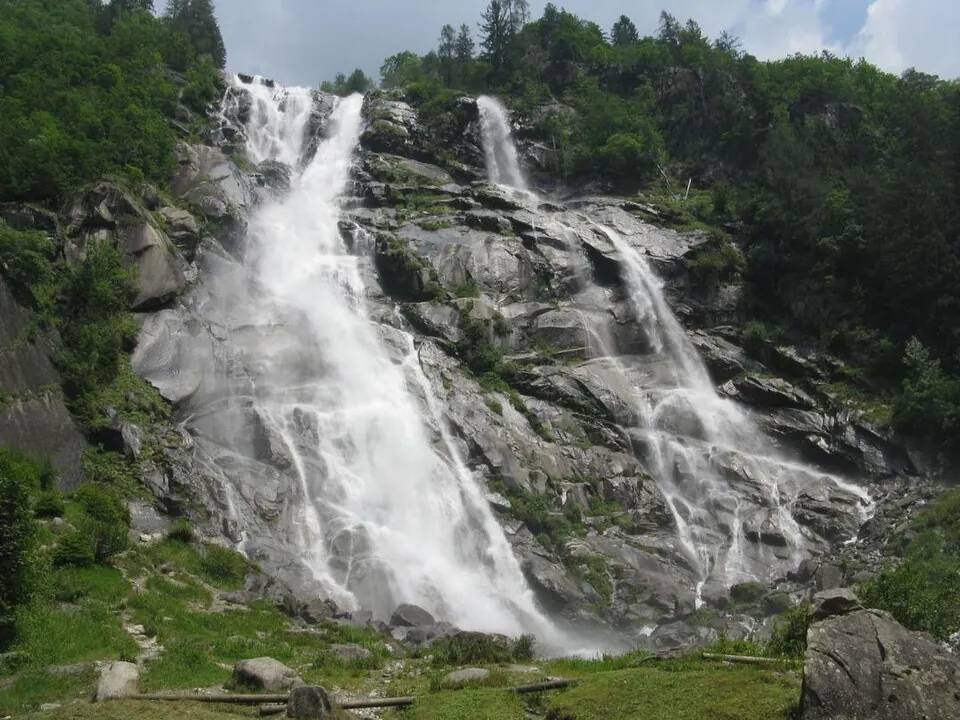
The 'valley of waterfalls' in the Adamello Brenta Park: a path along the Sarca passes one waterfall after another, starting with the Nardis, which pours down from the Presanella.
- Difficulty
- T Tourist
- Length
- 12.5 km
- Elevation gain
- +670 m / −20 m
- Time
- 4–4.5 hours (one way)
- Route
- Point to point
- Altitude
- 925–1587 m
- Season
- Summer
Download the GPXDirections to the start ↗
Saved. You'll find everything in My trip, where you can split it into days and see it on the map.
Saved on this device: you can open it even without a connection. All your saved pages are in Offline guides.
The topographic map loads OpenTopoMap tiles (an external server) only when you open it.
Why go
Because it is a wild valley with no villages, where water from the Adamello and Presanella glaciers falls from every wall.
Practical information
- Start
- Ponte Verde, entrance to Val Genova (Carisolo)
- Finish
- Malga Bedole, at the head of the valley; return by shuttle
- Best time
- June–September
- Parking
- Pay car parks in the valley; in summer traffic on the road is restricted.
- By public transport
- In summer, Adamello Brenta Park shuttles along the valley.
- Water
- Fountains and huts along the valley.
- Shade
- Plenty: woods along the Sarca river.
- Huts and refreshments
- Several huts and dairy farms along the valley, as far as Bedole.
- With children
- Yes, even just as far as the Nardis Falls.
Weather at the start
The forecast for the next 7 days at this spot: sky, temperatures, rain and wind.
Forecast by Open-Meteo (CC BY 4.0), from the models of national weather services. Your browser downloads it directly from Open-Meteo, and only when you ask. In the mountains and at sea the weather changes quickly: check the official forecast as well before you set off.
What to see on the route and nearby
More hikes in Trentino-South Tyrol
- 1The Adolf Munkel trail below the OdleE 5.8 km · +190 m · 3–3.5 hours · point to point
- 2Around Lago di BraiesT 3.5 km · +230 m · 1–1.5 hours · loop
- 3★ The Ponale roadT 5.3 km · +340 m · 2 hours round trip · out and back
- 4★ The Lagundo WaalwegT 4.3 km · +200 m · 1.5–2 hours · point to point
- 5★ From Tenno to the village of CanaleT 3.7 km · +200 m · 1 hour · out and back
- 6From Seceda to Col Raiser via PieralongiaE 3.8 km · +30 m · 1.5–2 hours · point to point
- 7The Vallunga from SelvaT 11.7 km · +260 m · 3–3.5 hours round trip · out and back
- 8Alpe di Siusi: from Compaccio to SaltriaT 5.8 km · +40 m · 1.5–2 hours · point to point
- 9Around the Sassolungo and SassopiattoEE 17.3 km · +900 m · 6–7 hours · loop
- 10Val Venegia to Baita SegantiniE 12.7 km · +510 m · 4–4.5 hours round trip · out and back
- 11From the Rolle Pass to Baita Segantini, snowshoes tooT 4 km · +200 m · 1.5–2 hours round trip · out and back
- 13From Vallesinella to Rifugio TuckettE 7.7 km · +680 m · 4.5–5 hours round trip · out and back
- 14Picco di Vallandro from Prato PiazzaE 8.4 km · +820 m · 4.5–5 hours round trip · out and back
- 15From Val Fiscalina to Rifugio Locatelli, facing the Tre CimeE 13.1 km · +950 m · 5.5–6 hours round trip · out and back
- 16Val Fiscalina to Rifugio FondovalleT 3.5 km · +70 m · 1–1.5 hours round trip · out and back
- 17★ From San Leonardo to Santa Croce via OiesE 9.6 km · +660 m · 4–4.5 hours round trip · out and back
- 18From Pederù to Rifugio Fanes and Lago di LimoE 12.5 km · +630 m · 4.5–5 hours round trip · out and back
- 19Saènt Waterfalls in Val di RabbiE 5.7 km · +480 m · 3–3.5 hours round trip · out and back
- 20★ Lago di Erdemolo in the Mòcheni valleyE 6.4 km · +470 m · 3 hours round trip · out and back
- 21★ Forra del Lupo, the Serrada trenchE 7.8 km · +400 m · 3–3.5 hours round trip · out and back
- 22Partschins Waterfall from the villageE 5.6 km · +450 m · 2.5–3 hours round trip · out and back
- 23Around Lago di TovelT 3.3 km · +20 m · 1–1.5 hours · loop
- 24Around Lago di AnterselvaT 3.7 km · +50 m · 1–1.5 hours · loop
- 25Path around Lago di CarezzaT 4 km · +140 m · 1–1.5 hours · loop
- 26The Tappeiner promenade in MeranoT 2.9 km · +220 m · 1–1.5 hours · point to point
- 27Viel dal Pan, the bread pathE 6.8 km · +220 m · 2.5–3 hours · point to point
Routes © OpenStreetMap contributors (ODbL), via Waymarked Trails and BRouter; elevations from a digital terrain model. Times and elevation gains are indicative: waymarks on the ground and closure orders always take precedence.