From the Passo Giau to the Rifugio Croda da Lago via Mondeval
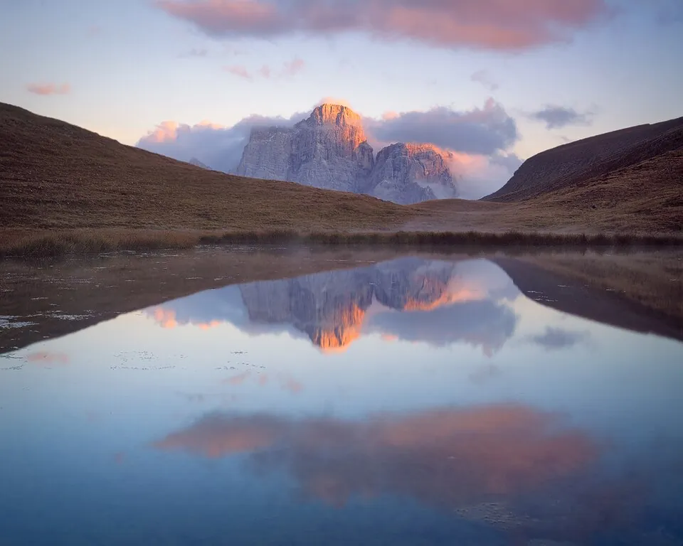
A high-level traverse across the Mondeval pastures and over Forcella Ambrizzola, to Lago Federa at the foot of the Croda da Lago.
- Difficulty
- E Hiking
- Length
- 14.5 km
- Elevation gain
- +650 m / −650 m
- Time
- 5.5–6 hours round trip
- Route
- Out and back
- Altitude
- 2035–2360 m
- Season
- Summer
Download the GPXDirections to the start ↗
Saved. You'll find everything in My trip, where you can split it into days and see it on the map.
Saved on this device: you can open it even without a connection. All your saved pages are in Offline guides.
The topographic map loads OpenTopoMap tiles (an external server) only when you open it.
The story
On the Mondeval plateau, in 1987, the burial of a Mesolithic hunter who lived about 7,500 years ago was found, together with his grave goods: the «Mondeval Man» is now on display in the museum at Selva di Cadore.
Why go
Because it combines one of Cortina's most beautiful lakes with a plateau where people were already hunting in prehistoric times, with the Pelmo and the Civetta always in view.
Practical information
- Start
- Passo Giau (trail 436)
- Finish
- Rifugio Croda da Lago and Lago Federa, 2046 m; back the same way
- Best time
- July–September
- Parking
- At Passo Giau.
- By public transport
- In summer, bus from Cortina to the Passo Giau (check the timetable).
- Water
- Only at the mountain hut.
- Shade
- None until the lake.
- Huts and refreshments
- Rifugio Croda da Lago – Gianni Palmieri.
- With children
- With fit children: long, with ups and downs.
Weather at the start
The forecast for the next 7 days at this spot: sky, temperatures, rain and wind.
Forecast by Open-Meteo (CC BY 4.0), from the models of national weather services. Your browser downloads it directly from Open-Meteo, and only when you ask. In the mountains and at sea the weather changes quickly: check the official forecast as well before you set off.
What to see on the route and nearby
- Cortina d'AmpezzoOn the route
- Cinque Torri and Lagazuoi3 km from the start
- Lago di Sorapis13 km from the start
More hikes in Veneto
- 1Tre Cime di Lavaredo, from the Rifugio Auronzo to the LocatelliE 7.4 km · +440 m · 3–3.5 hours · out and back
- 2Lago di Sorapis from the Passo Tre CrociE 10.5 km · +730 m · 4–4.5 hours · out and back
- 3★ Road of the 52 Tunnels on the PasubioEE 10.6 km · +1210 m · 5–6 hours · point to point
- 4★ Cansiglio Forest loopT 17.2 km · +420 m · 4.5–5 hours · loop
- 6From the Passo Giau to the Rifugio NuvolauE 6.1 km · +410 m · 3.5 hours round trip · out and back
- 7★ Lago di Limides from the Passo FalzaregoT 3.1 km · +80 m · 1–1.5 hours round trip · out and back
- 8Lago di Misurina circuitT 3.2 km · +30 m · 45 minutes – 1 hour · loop
- 9★ Monte Piana, the open-air Great War museumE 10.6 km · +750 m · 4–4.5 hours round trip · out and back
- 10Lago and Rifugio Coldai below the CivettaE 10.2 km · +700 m · 4.5–5 hours round trip · out and back
- 11★ Rifugio Dal Piaz from the Passo Croce d'AuneE 9.2 km · +940 m · 4.5–5 hours round trip · out and back
- 12Monte Ortigara from Piazzale LozzeE 5.6 km · +310 m · 3 hours round trip · out and back
- 13★ Calà del Sasso, the longest stairway in ItalyE 6.6 km · +720 m · 4–4.5 hours round trip · out and back
- 14From Sant'Uberto to Malga Ra Stua, in winter tooT 5.8 km · +190 m · 2–2.5 hours round trip · out and back
- 15★ Lago di Alleghe circuitT 3 km · +20 m · 1 hour · loop
Routes © OpenStreetMap contributors (ODbL), via Waymarked Trails and BRouter; elevations from a digital terrain model. Times and elevation gains are indicative: waymarks on the ground and closure orders always take precedence.