Lago and Rifugio Coldai below the Civetta
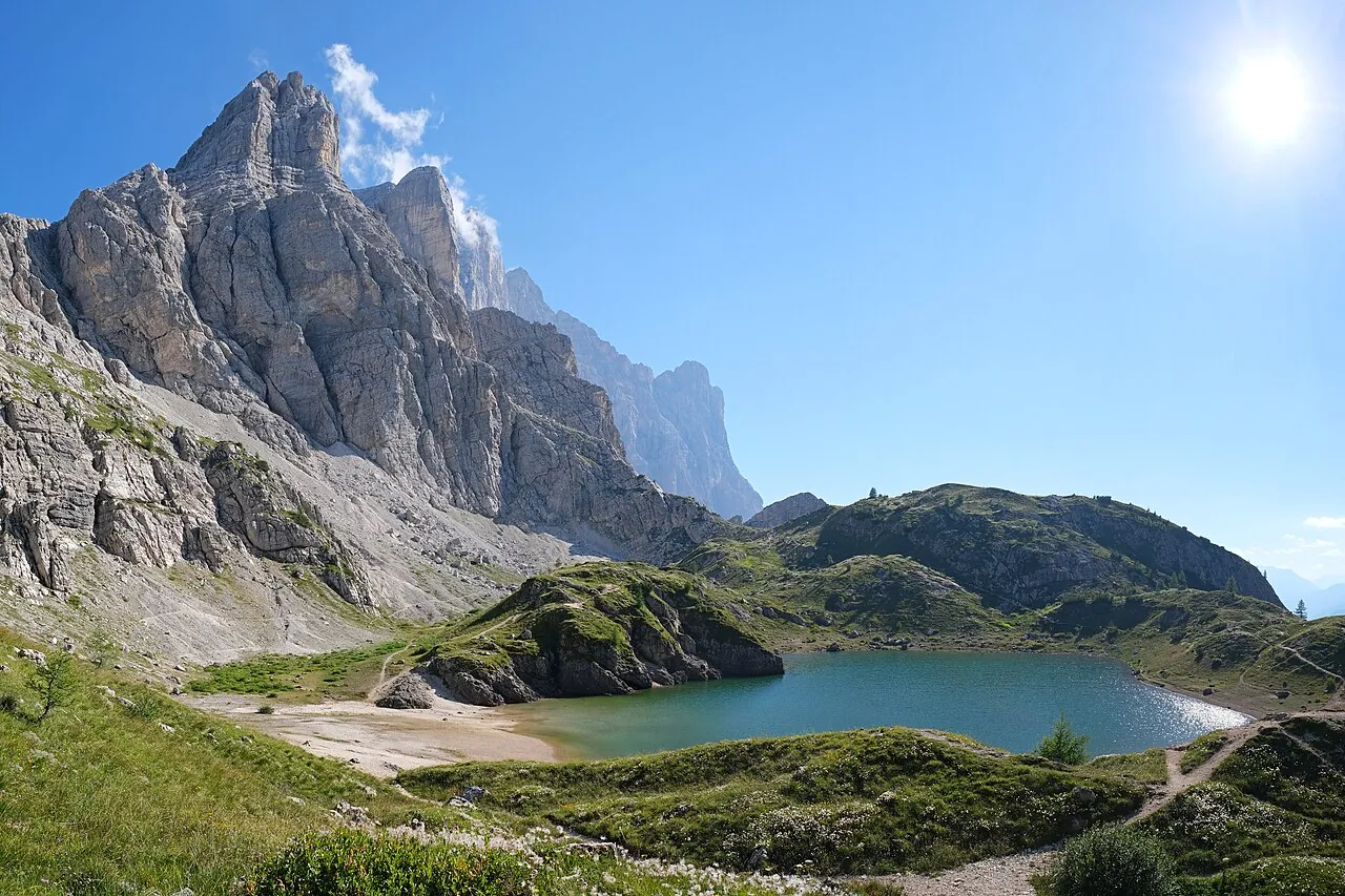
One of the classic climbs of the Belluno Dolomites, up to an alpine lake set beneath the Civetta.
- Difficulty
- E Hiking
- Length
- 10.2 km
- Elevation gain
- +700 m / −700 m
- Time
- 4.5–5 hours round trip
- Route
- Out and back
- Altitude
- 1514–2193 m
- Season
- Summer
Download the GPXDirections to the start ↗
Saved. You'll find everything in My trip, where you can split it into days and see it on the map.
Saved on this device: you can open it even without a connection. All your saved pages are in Offline guides.
The topographic map loads OpenTopoMap tiles (an external server) only when you open it.
Why go
Because a few steps beyond the lake you look out on the north-west face of the Civetta, which climbers call «the wall of walls».
Practical information
- Start
- Palafavera, Val di Zoldo (trails 564 and 556)
- Finish
- Rifugio Coldai and Lago Coldai; back the same way
- Best time
- July–September
- Parking
- At Palafavera.
- By public transport
- Val di Zoldo buses; in summer, a chairlift from Pecol to Col dei Baldi shortens the climb.
- Water
- At the Rifugio Coldai.
- Shade
- Woodland in the first part.
- Huts and refreshments
- Rifugio Sonino al Coldai.
- With children
- With fit children.
Weather at the start
The forecast for the next 7 days at this spot: sky, temperatures, rain and wind.
Forecast by Open-Meteo (CC BY 4.0), from the models of national weather services. Your browser downloads it directly from Open-Meteo, and only when you ask. In the mountains and at sea the weather changes quickly: check the official forecast as well before you set off.
What to see on the route and nearby
More hikes in Veneto
- 1Tre Cime di Lavaredo, from the Rifugio Auronzo to the LocatelliE 7.4 km · +440 m · 3–3.5 hours · out and back
- 2Lago di Sorapis from the Passo Tre CrociE 10.5 km · +730 m · 4–4.5 hours · out and back
- 3★ Road of the 52 Tunnels on the PasubioEE 10.6 km · +1210 m · 5–6 hours · point to point
- 4★ Cansiglio Forest loopT 17.2 km · +420 m · 4.5–5 hours · loop
- 5From the Passo Giau to the Rifugio Croda da Lago via MondevalE 14.5 km · +650 m · 5.5–6 hours round trip · out and back
- 6From the Passo Giau to the Rifugio NuvolauE 6.1 km · +410 m · 3.5 hours round trip · out and back
- 7★ Lago di Limides from the Passo FalzaregoT 3.1 km · +80 m · 1–1.5 hours round trip · out and back
- 8Lago di Misurina circuitT 3.2 km · +30 m · 45 minutes – 1 hour · loop
- 9★ Monte Piana, the open-air Great War museumE 10.6 km · +750 m · 4–4.5 hours round trip · out and back
- 11★ Rifugio Dal Piaz from the Passo Croce d'AuneE 9.2 km · +940 m · 4.5–5 hours round trip · out and back
- 12Monte Ortigara from Piazzale LozzeE 5.6 km · +310 m · 3 hours round trip · out and back
- 13★ Calà del Sasso, the longest stairway in ItalyE 6.6 km · +720 m · 4–4.5 hours round trip · out and back
- 14From Sant'Uberto to Malga Ra Stua, in winter tooT 5.8 km · +190 m · 2–2.5 hours round trip · out and back
- 15★ Lago di Alleghe circuitT 3 km · +20 m · 1 hour · loop
Routes © OpenStreetMap contributors (ODbL), via Waymarked Trails and BRouter; elevations from a digital terrain model. Times and elevation gains are indicative: waymarks on the ground and closure orders always take precedence.