Gran Cratere of Vulcano
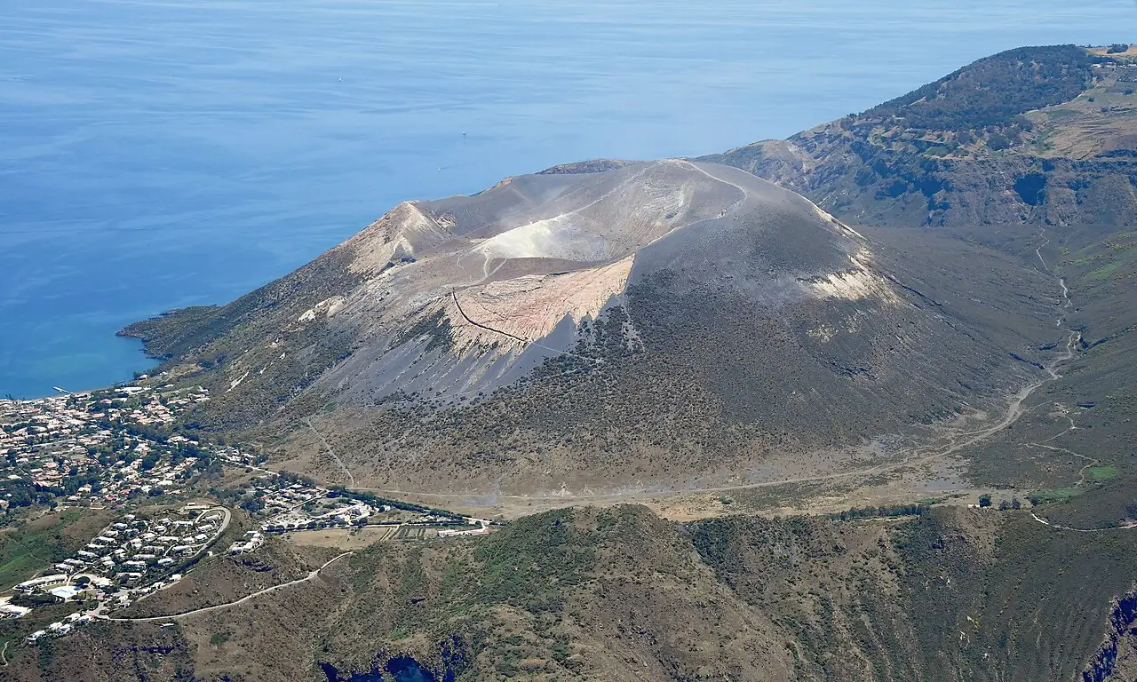
A path of sand and ash climbs the cone of the Fossa di Vulcano to the rim of the crater, among yellow sulphur fumaroles, with a view over all the Aeolian Islands.
- Difficulty
- E Hiking
- Length
- 4.7 km
- Elevation gain
- +260 m / −260 m
- Time
- 2–2.5 hours
- Route
- Out and back
- Altitude
- 66–355 m
- Season
- Spring Autumn Winter
Download the GPXDirections to the start ↗
Saved. You'll find everything in My trip, where you can split it into days and see it on the map.
Saved on this device: you can open it even without a connection. All your saved pages are in Offline guides.
The topographic map loads OpenTopoMap tiles (an external server) only when you open it.
The story
For the Greeks and Romans this was the forge of Hephaestus, the god of fire whom the Romans called Vulcan: every volcano in the world takes its name from this island. The last eruption was in 1888–1890, and gave its name to «Vulcanian» eruptions. The Aeolian Islands are a UNESCO World Heritage Site.
Why go
Because you walk on the rim of an active volcano, and the view over the seven islands is unforgettable.
Practical information
- Start
- Vulcano Porto (trailhead a few minutes' walk from the harbour)
- Finish
- Rim of the Gran Cratere (about 390 m), back the same way
- Best time
- October–May; in summer only at dawn
- Parking
- Not needed: you set off on foot from the harbour.
- By public transport
- Hydrofoils and ferries from Milazzo and the other Aeolian Islands.
- Water
- At the harbour; nothing along the trail.
- Shade
- None.
- Huts and refreshments
- None.
- With children
- Yes, with children used to walking: a short climb, but on slippery volcanic sand.
Weather at the start
The forecast for the next 7 days at this spot: sky, temperatures, rain and wind.
Forecast by Open-Meteo (CC BY 4.0), from the models of national weather services. Your browser downloads it directly from Open-Meteo, and only when you ask. In the mountains and at sea the weather changes quickly: check the official forecast as well before you set off.
What to see on the route and nearby
More hikes in Sicily
- 2From Sortino to the necropolis of PantalicaE 3.9 km · +130 m · 1.5–2 hours · point to point
- 3★ The coastal loop of Monte CofanoE 7.8 km · +250 m · 2.5–3 hours · loop
- 4The Rocca of Cefalù and the Temple of DianaT 1.8 km · +170 m · 1.5–2 hours round trip, including the visit · out and back
Routes © OpenStreetMap contributors (ODbL), via Waymarked Trails and BRouter; elevations from a digital terrain model. Times and elevation gains are indicative: waymarks on the ground and closure orders always take precedence.