Rifugio Bonatti in Val Ferret
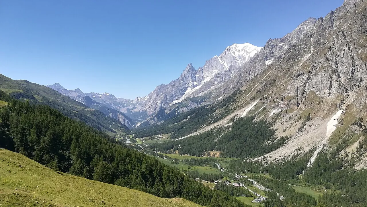
A short climb to the pastures above Val Ferret, up to the hut with one of the finest views of the Italian side of Mont Blanc: the Grandes Jorasses straight ahead.
- Difficulty
- E Hiking
- Length
- 2.9 km
- Elevation gain
- +320 m / −320 m
- Time
- 2–2.5 hours
- Route
- Out and back
- Altitude
- 1708–2048 m
- Season
- Summer
Download the GPXDirections to the start ↗
Saved. You'll find everything in My trip, where you can split it into days and see it on the map.
Saved on this device: you can open it even without a connection. All your saved pages are in Offline guides.
The topographic map loads OpenTopoMap tiles (an external server) only when you open it.
The story
The hut is named after Walter Bonatti, the climber who opened some of the boldest routes of the 20th century on these mountains and lived for many years in Courmayeur. Inside, photographs of his expeditions tell his life story.
Why go
Because with little effort you sit facing Mont Blanc, and from here you can continue along the Val Ferret balcony, one of the most beautiful stretches of the Tour du Mont Blanc.
Practical information
- Start
- La Remisa, Val Ferret (Courmayeur)
- Finish
- Rifugio Walter Bonatti (2,025 m), back the same way
- Best time
- June–September
- Parking
- Car parks along the Val Ferret road; in summer traffic on the road may be restricted.
- By public transport
- Summer shuttle from Courmayeur along Val Ferret.
- Water
- At the mountain hut.
- Shade
- Little.
- Huts and refreshments
- Rifugio Walter Bonatti (seasonal).
- With children
- Yes.
Weather at the start
The forecast for the next 7 days at this spot: sky, temperatures, rain and wind.
Forecast by Open-Meteo (CC BY 4.0), from the models of national weather services. Your browser downloads it directly from Open-Meteo, and only when you ask. In the mountains and at sea the weather changes quickly: check the official forecast as well before you set off.
What to see on the route and nearby
- Val FerretOn the route
- CourmayeurOn the route
- Mont Blanc and Skyway7 km from the start
- ★ Vineyards of Morgex and La Salle11 km from the start
More hikes in Aosta Valley
- 1Rifugio Vittorio Sella from ValnonteyE 10.1 km · +900 m · 5–6 hours · out and back
- 2★ Lago di Loie from LillazE 7.1 km · +810 m · 4 hours · out and back
- 4★ Ru MarseillerT 11.5 km · +510 m · 3–3.5 hours · point to point
- 5★ Lago di Miserin and Finestra di ChamporcherE 13 km · +720 m · 4–5 hours · out and back
- 6★ On foot to Chamois, the car-free villageE 4.9 km · +460 m · 2.5 hours · point to point
- 7★ Rifugio Oriondé and Croce CarrelEE 9.5 km · +880 m · 5 hours · out and back
- 8Rutor Waterfalls and Rifugio Deffeyes from La ThuileE 10.4 km · +880 m · 5–5.5 hours round trip · out and back
- 9Lago Blu, the Matterhorn's mirrorT 3.3 km · +20 m · 1 hour round trip · out and back
- 10Rifugio Elisabetta and Lac Combal in Val VenyE 12.4 km · +560 m · 4.5–5 hours round trip · out and back
- 11★ Lago d'Arpy from Colle San CarloT 6.4 km · +130 m · 1.5–2 hours round trip · out and back
Routes © OpenStreetMap contributors (ODbL), via Waymarked Trails and BRouter; elevations from a digital terrain model. Times and elevation gains are indicative: waymarks on the ground and closure orders always take precedence.