Rifugio Elisabetta and Lac Combal in Val Veny
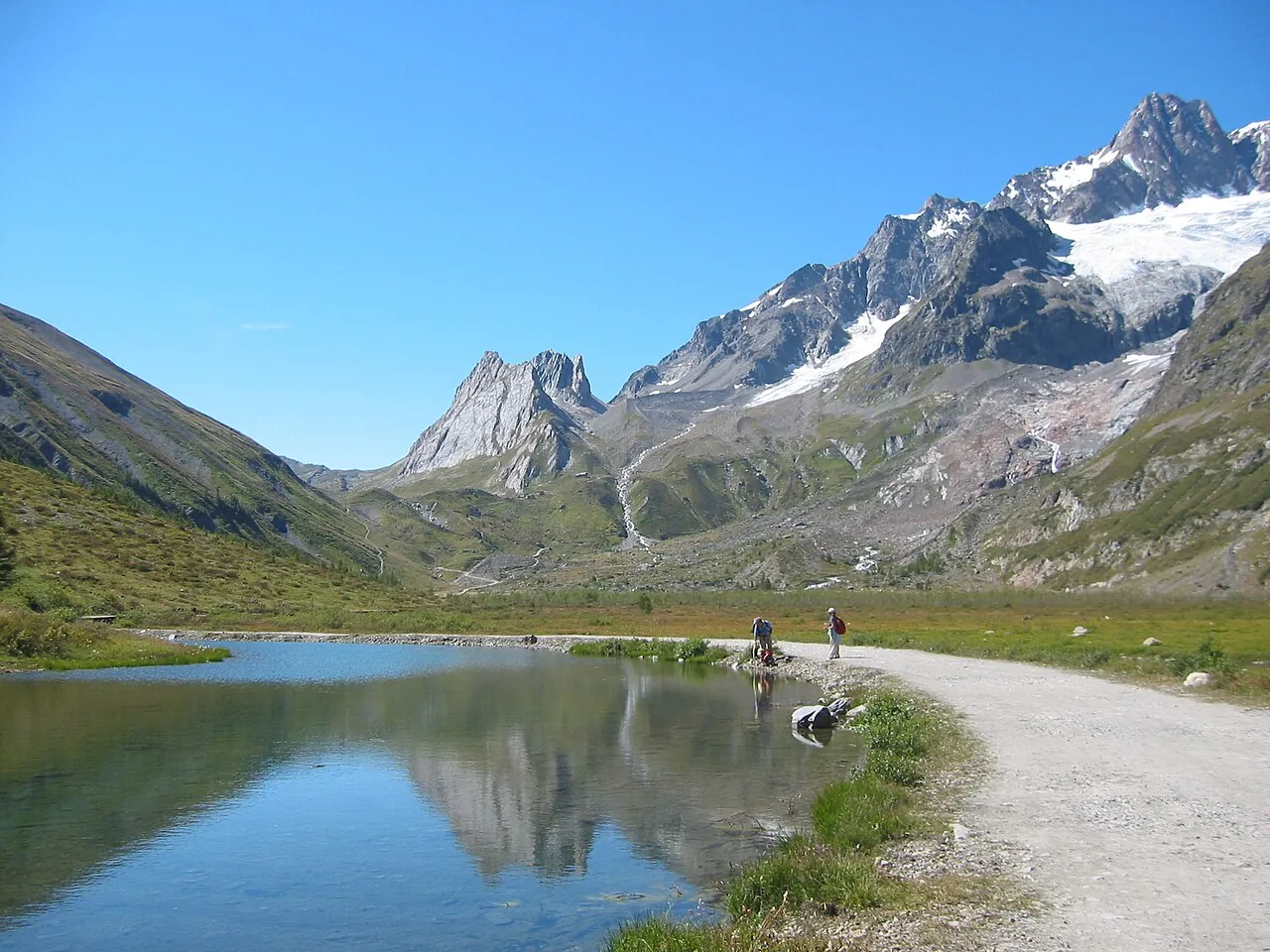
A walk along the floor of Val Veny, below the Italian side of Mont Blanc: you skirt the moraine of the Miage glacier and the marshy plain of Lac Combal, then climb to the hut.
- Difficulty
- E Hiking
- Length
- 12.4 km
- Elevation gain
- +560 m / −560 m
- Time
- 4.5–5 hours round trip
- Route
- Out and back
- Altitude
- 1644–2187 m
- Season
- Summer
Download the GPXDirections to the start ↗
Saved. You'll find everything in My trip, where you can split it into days and see it on the map.
Saved on this device: you can open it even without a connection. All your saved pages are in Offline guides.
The topographic map loads OpenTopoMap tiles (an external server) only when you open it.
Why go
Because it is a stretch of the Tour du Mont Blanc within everyone's reach, with glaciers a few steps away and the Pyramides Calcaires above the hut.
Practical information
- Start
- La Visaille, Val Veny (Courmayeur)
- Finish
- Rifugio Elisabetta Soldini, about 2,200 m; back the same way
- Best time
- July–September
- Parking
- At La Visaille; in summer traffic on the Val Veny road may be restricted, with a shuttle from Courmayeur.
- By public transport
- Summer shuttle from Courmayeur to Val Veny.
- Water
- At Rifugio Combal and Rifugio Elisabetta.
- Shade
- None after La Visaille.
- Huts and refreshments
- Cabane du Combal, Rifugio Elisabetta.
- With children
- Yes as far as Lac Combal, almost flat; the climb to the hut after that is steep.
Weather at the start
The forecast for the next 7 days at this spot: sky, temperatures, rain and wind.
Forecast by Open-Meteo (CC BY 4.0), from the models of national weather services. Your browser downloads it directly from Open-Meteo, and only when you ask. In the mountains and at sea the weather changes quickly: check the official forecast as well before you set off.
What to see on the route and nearby
- Mont Blanc and SkywayOn the route
- CourmayeurOn the route
- ★ Vineyards of Morgex and La Salle10 km from the start
- Val Ferret10 km from the start
- Rutor Waterfalls13 km from the start
More hikes in Aosta Valley
- 1Rifugio Vittorio Sella from ValnonteyE 10.1 km · +900 m · 5–6 hours · out and back
- 2★ Lago di Loie from LillazE 7.1 km · +810 m · 4 hours · out and back
- 3Rifugio Bonatti in Val FerretE 2.9 km · +320 m · 2–2.5 hours · out and back
- 4★ Ru MarseillerT 11.5 km · +510 m · 3–3.5 hours · point to point
- 5★ Lago di Miserin and Finestra di ChamporcherE 13 km · +720 m · 4–5 hours · out and back
- 6★ On foot to Chamois, the car-free villageE 4.9 km · +460 m · 2.5 hours · point to point
- 7★ Rifugio Oriondé and Croce CarrelEE 9.5 km · +880 m · 5 hours · out and back
- 8Rutor Waterfalls and Rifugio Deffeyes from La ThuileE 10.4 km · +880 m · 5–5.5 hours round trip · out and back
- 9Lago Blu, the Matterhorn's mirrorT 3.3 km · +20 m · 1 hour round trip · out and back
- 11★ Lago d'Arpy from Colle San CarloT 6.4 km · +130 m · 1.5–2 hours round trip · out and back
Routes © OpenStreetMap contributors (ODbL), via Waymarked Trails and BRouter; elevations from a digital terrain model. Times and elevation gains are indicative: waymarks on the ground and closure orders always take precedence.