Gorropu Gorge from Genna Silana
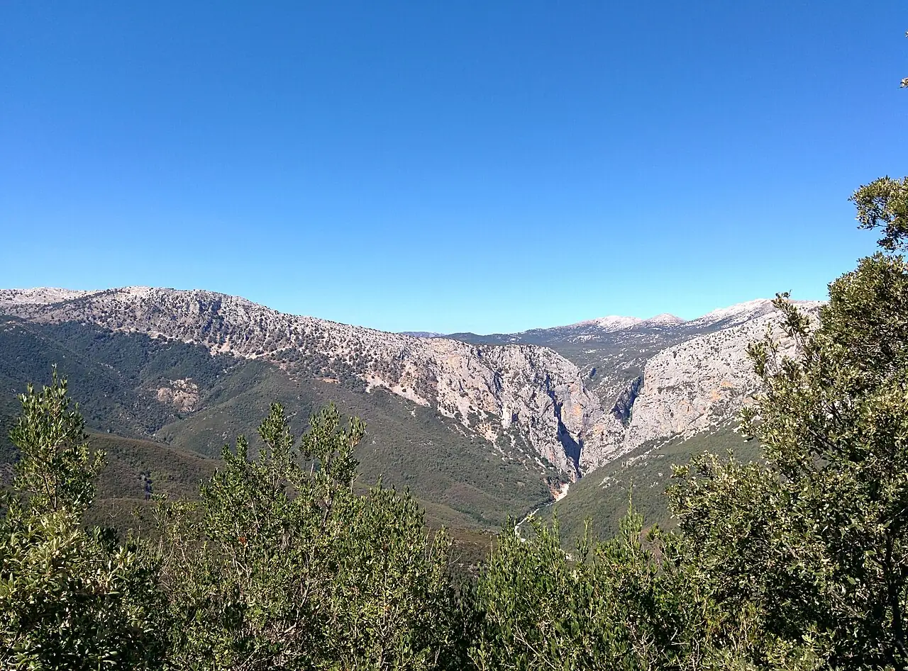
A trail among holm oaks and limestone rocks descends from the Supramonte to the bed of the Rio Flumineddu and the entrance to the Gorropu Gorge, a canyon with walls up to 500 metres high.
- Difficulty
- E Hiking
- Length
- 8 km
- Elevation gain
- +600 m / −600 m
- Time
- 5–6 hours
- Route
- Out and back
- Altitude
- 384–1006 m
- Season
- Spring Autumn
Download the GPXDirections to the start ↗
Saved. You'll find everything in My trip, where you can split it into days and see it on the map.
Saved on this device: you can open it even without a connection. All your saved pages are in Offline guides.
The topographic map loads OpenTopoMap tiles (an external server) only when you open it.
The story
Gorropu is one of the deepest canyons in Europe, carved into the limestone by the Rio Flumineddu. A flower found nowhere else grows in the gorge, the nuragic columbine, and inside, among huge boulders, the route turns into an easy scramble. The trail from Genna Silana was used by shepherds and charcoal burners.
Why go
Because stepping between those vertical walls is an experience you never forget.
Practical information
- Start
- Genna Silana pass (SS125, about 1000 m)
- Finish
- Entrance to the Gorropu Gorge, back the same way
- Best time
- April–June and September–October
- Parking
- Car park at the Genna Silana pass, on the Orientale Sarda road.
- By public transport
- You need a car.
- Water
- Nothing along the trail: carry at least two litres; there is a seasonal refreshment point at the entrance to the gorge.
- Shade
- Holm oak wood for part of the descent.
- Huts and refreshments
- None: the ticket point at the entrance to the gorge.
- With children
- With fit teenagers: a long descent and, above all, a long climb back.
Weather at the start
The forecast for the next 7 days at this spot: sky, temperatures, rain and wind.
Forecast by Open-Meteo (CC BY 4.0), from the models of national weather services. Your browser downloads it directly from Open-Meteo, and only when you ask. In the mountains and at sea the weather changes quickly: check the official forecast as well before you set off.
What to see on the route and nearby
- Gorropu GorgeOn the route
- Dorgali and Cala GononeOn the route
- ★ Tiscali village9 km from the start
- Cala Sisine11 km from the start
- Cala Luna13 km from the start
More hikes in Sardinia
- 2Nuragic village of TiscaliEE 8.5 km · +630 m · 4–5 hours · out and back
- 3Cala Luna from Cala FuiliE 9.6 km · +260 m · 3–3.5 hours · out and back
- 4Punta La Marmora from Bruncu SpinaE 9.6 km · +500 m · 3–3.5 hours · out and back
- 5Cala Goloritzé from the Golgo plateauE 6.8 km · +480 m · 3 hours round trip · out and back
Routes © OpenStreetMap contributors (ODbL), via Waymarked Trails and BRouter; elevations from a digital terrain model. Times and elevation gains are indicative: waymarks on the ground and closure orders always take precedence.